

11 km and 700 m of elevation gain / 850 m of elevation loss


1/11
Show all 11 photos
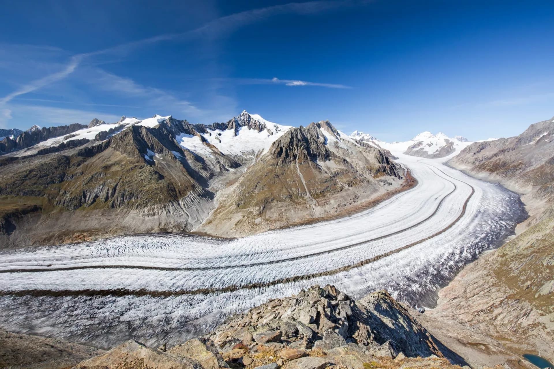
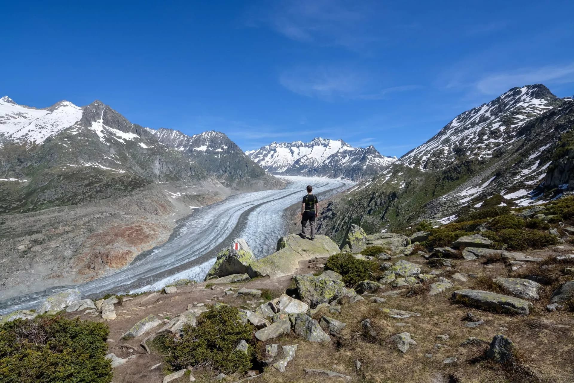
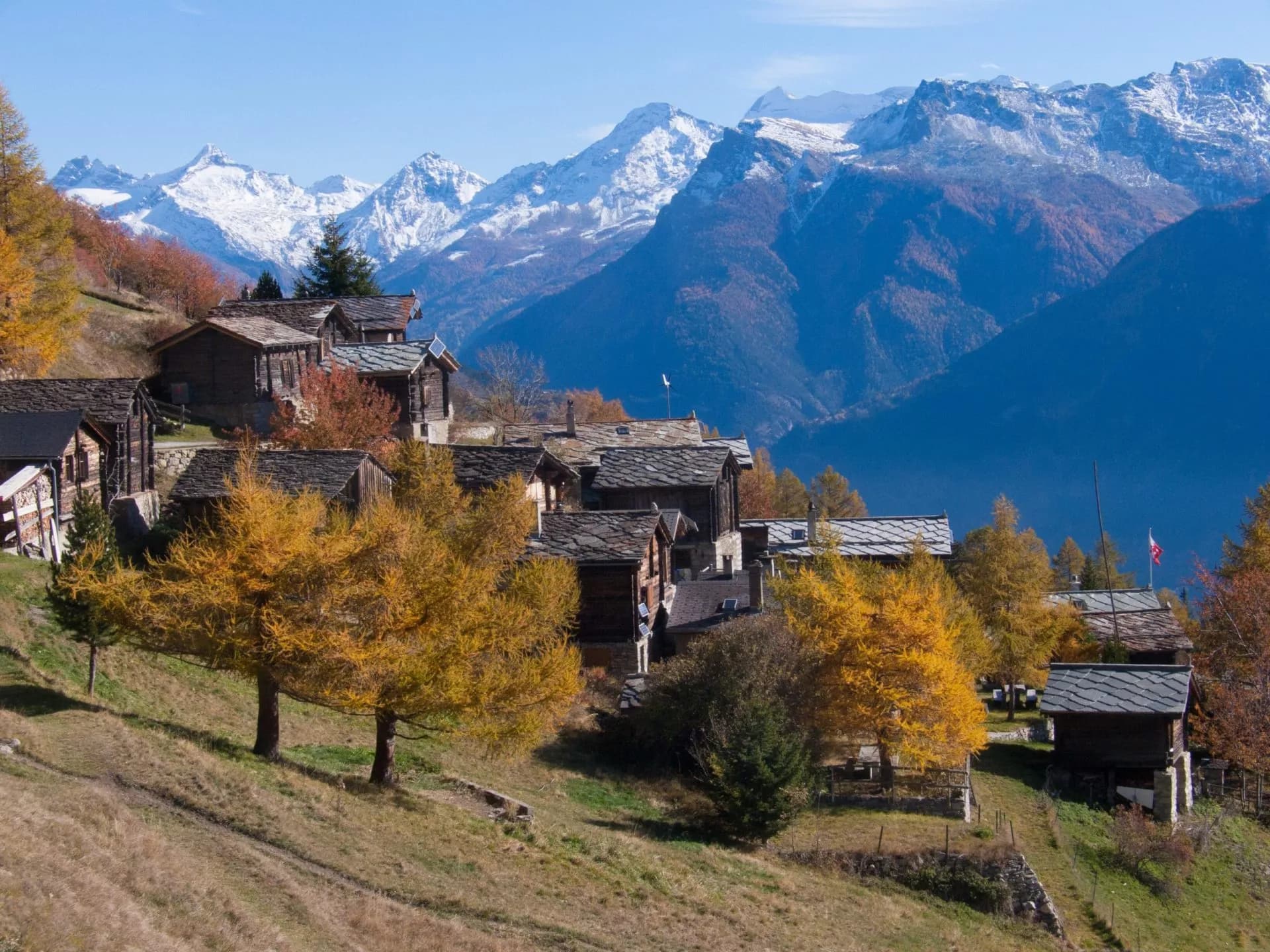
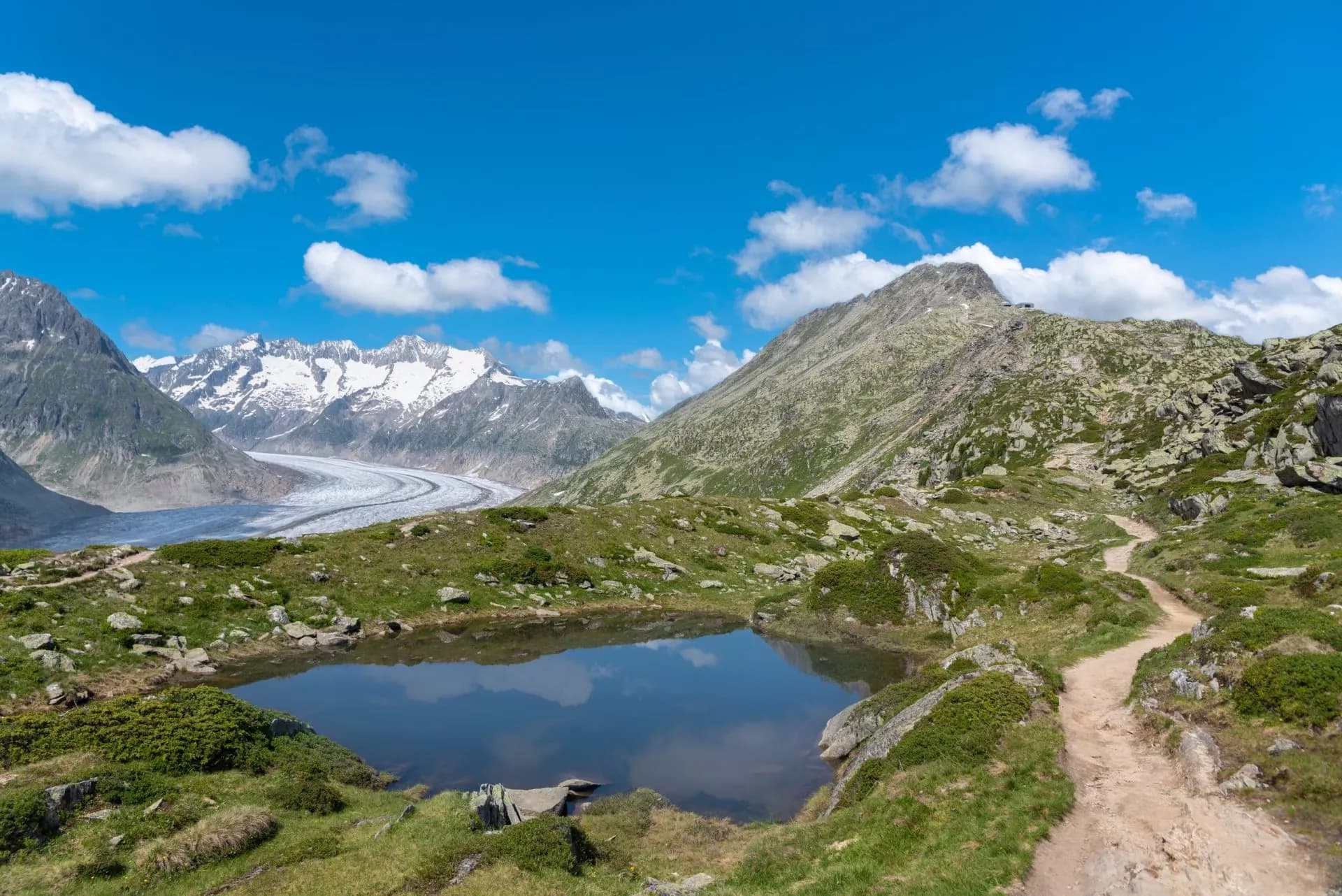
Aletsch Glacier Panorama Trail
4 days / 3 nights
|
Hike beside the Alps’ largest glacier on a trail that stuns at every step – four days of wild beauty, sky-high ridges, and pure alpine exhilaration.
Hike beside the Alps’ largest glacier on a trail that stuns at every step – four days of wild beauty, sky-high ridges, and pure alpine exhilaration.
Hike beside the Alps’ largest glacier on a trail that stuns at every step – four days of wild beauty, sky-high ridges, and pure alpine exhilaration.
Highlights
- Discover the longest glacier in the Alps up close
- Explore the car-free mountain villages like Riederalp and Fiescheralp
- Cross the legendary Aletsch Forest with historic trees over 900 years old
- Relax after a day of hiking with delicious Swiss cuisine and Valais wine
- Hike along the panoramic trail with an incredible view of the glacier and the highest Swiss peaks
- Enjoy the sunrise views over 4,000 m peaks from your hotel balcony
What’s included in the price?
Self-guided
Are you looking for a good adventure and limitless flexibility? Then you should try out a self-guided tour, perfect for independent explorers who want to set their own pace. Without the need to stick to a group schedule, you’re free to linger at scenic viewpoints while the logistics are taken care of in advance.
INCLUDED
3 nights in a 3* hotel with breakfast or B&B
Digital guidebook with itinerary, route instructions, and practical information
GPS navigation with an easy-to-use app
Tour design and organization
Service and support during your hike
Luggage transfer
NOT INCLUDED
Gondola ticket
Tourist tax
OPTIONAL EXTRAS
Airport transfer
Extra nights
Hotel upgrades
Single supplement
Accommodation levelComfort
Carefully selected 3- and 4-star hotels, guesthouses, and B&Bs, all with private en-suite rooms and breakfast included. Expect comfortable, well-appointed rooms with attentive hospitality, typically in convenient and scenic locations — some properties also offer on-site dining.
These are examples of the type and standard you can expect. Actual properties may vary depending on availability.
What to bring to the tour
- Hiking shoes/boots
- 25 to 45-liter backpack
- Base layer
- Sports T-shirts
- Hiking shorts
- Hiking water-repellent pants
- Waterproof jacket
- Midlayer
- Sports socks and underwear
- Leisurewear for evenings
- Down jacket
- Gloves
- Shade hat/cap
- Warm headwear
- Sunscreen
- Sunglasses
- Headlamp
- Hiking poles
- ID card or passport
- Snacks
- Cash
- Water bottles or hydration pack
- Sleeping liner
- Toiletries
- Toilet paper
- Small first aid kit
Looking for a high-alpine adventure that’s breathtaking but accessible?
The Aletsch Glacier Panorama Trail is perfect for active hikers who want big mountain views without technical climbing. If you love panoramic trails, remote villages, and hiking at your own pace—this 3-day glacier trek is for you.
Here, you don’t just see the Alps—you walk beside their beating heart. The Aletsch Glacier, at 23 kilometers, is the largest glacier in the Alps. Towering ice, ancient forests, and the silence of altitude combine into something truly extraordinary. This is a chance to witness a vanishing wonder—before it’s gone.
Each day places you on a natural balcony, high above the world, with the glacier to one side and 4,000-meter peaks to the other.
The trail leads you through the Aletsch Forest, home to some of the oldest trees in Switzerland—gnarled, wind-sculpted Swiss stone pines that have stood for over 900 years. Surrounded by silence, glacier views, and the scent of alpine pine, the atmosphere is nothing short of magica
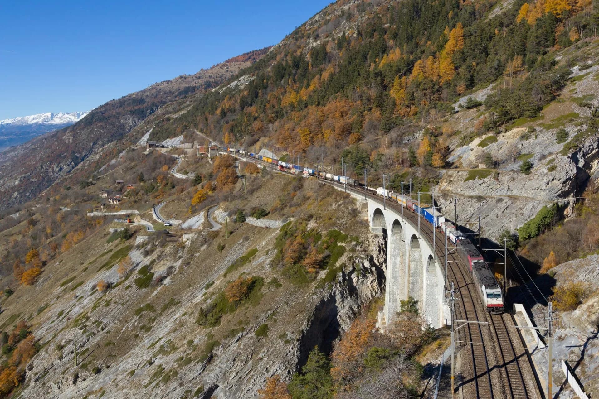
Add in panoramic ridge walks, shimmering glacial lakes, the surreal glow of the Tälligrat tunnel, and the thrill of crossing a 160-meter suspension bridge—and you have a journey that’s rich in drama and beauty from start to finish.
We take care of all the details so you can focus on enjoying your adventure. We book the accommodations and provide a detailed itinerary booklet, GPS routes, and 24/7 support. Our goal is to make your hike as stress-free and enjoyable as possible.
This is more than a hike—it’s a rare chance to walk beside a frozen giant, through a landscape shaped by time.
Frequently Asked Questions

Hassle-Free
We handle itineraries, accommodations, and anything else you prefer not to deal with, so you can enjoy a carefree hike.

Book with confidence
We are a financially protected company, fully bonded and insured, keeping your money safe and allowing you to travel with confidence.

Tried & Tested Adventures
Only the best hut to hut hikes of Switzerland, cherry-picked by our local team with an in-depth knowledge of the region.

Unbeatable support
Our 24/7 customer support is where we show our passion, bringing you a better experience by making your well-being our number one priority.
from 1.090 € /person