Via Alpina Switzerland: Ultimate Guide
Via Alpina Switzerland made simple: 18 days, 14 passes across 7 cantons, clear waymarking, flexible stage options, and the best time to go.

Quick links
Via Alpina at a Glance
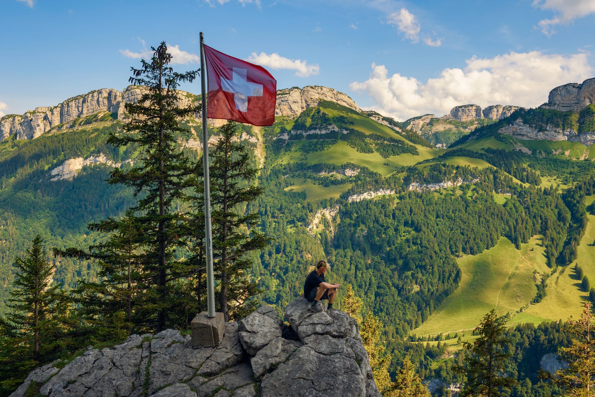
The Via Alpina — also known as the Via Alpina Green Trail or Switzerland's National Route No. 1 — is the ultimate way to cross the Swiss Alps from east to west. Also called the Swiss Alpine Pass Route (previously known as the Alpine Pass Route), it strings together 14 mountain passes across 18 stages of some of the most diverse Alpine scenery in Europe. Whether you hike every last kilometre or join for the most scenic stretch, no long-distance trail in Switzerland gives you a fuller picture of the country.
Main Facts About Via Alpina
1. Route: Sargans (border with Liechtenstein) → Montreux (Lake Geneva)
2. Total distance: ~390 km
3. Stages: 18 days of hiking
4. Passes crossed: 14 mountain passes across 7 Swiss cantons
5. Highest point: Hohtürli Pass at 2,778 m (optional side-trip to Blüemlisalphütte at 2,834 m)
6. Cumulative elevation gain: ~16,000 m over the full route
7. Average stage: ~21 km and ~1,200 m of ascent per day
8. Technical difficulty: 3/5 — no climbing required; some exposed sections
9. Fitness level: 5/5 — sustained multi-week effort required
10. Best season: mid-July to end of September
For the full picture of what summer conditions look like across Switzerland, see our summer hiking guide.
11. Duration options: 18 days (full Via Alpina Switzerland) or 9 days (Via Alpina Bear Trek — the Bernese Oberland highlights section)
12. Accommodation: valley hotels, inns, and occasional mountain huts; most stages offer multiple options
13. Trail marking: red and white alpine blazes + yellow signs on lower-level paths
14. Part of: the wider Via Alpina pan-European network across 8 Alpine countries — 342 stages in total
Via Alpina Route Map
What Is Via Alpina?
The Via Alpina Switzerland — officially designated as Via Alpina 1 and colour-coded the Via Alpina Green Trail — is Switzerland's section of a much larger international hiking network. The full pan-European Via Alpina network spans eight Alpine countries, from Monaco to Slovenia, across 342 stages and more than 5,000 km of trails. The Swiss segment covers 18 of those stages.
For how the Via Alpina compares to the other great Swiss hikes, see our guide to the top hikes in Switzerland.
The route's origins trace back to 1991, when the eight Alpine nations signed an international treaty committing to the sustainable development of the Alpine region. A proposition for a trail linking all countries followed, and the network was officially launched in 2002. Switzerland's section forms the backbone of the green trail — the route most hikers mean when they talk about hiking the Via Alpina.
A word on naming, since it causes regular confusion. The route was previously known as the Alpine Pass Route — a fitting name, given the 14 passes it crosses. That name is now used for a different Swiss long-distance trail. Today the official name is the Via Alpina Green Trail (or simply Via Alpina 1), listed as Swiss National Route No. 1. On the ground, signs will show both the Via Alpina logo and the standard Swiss hiking waymarks.
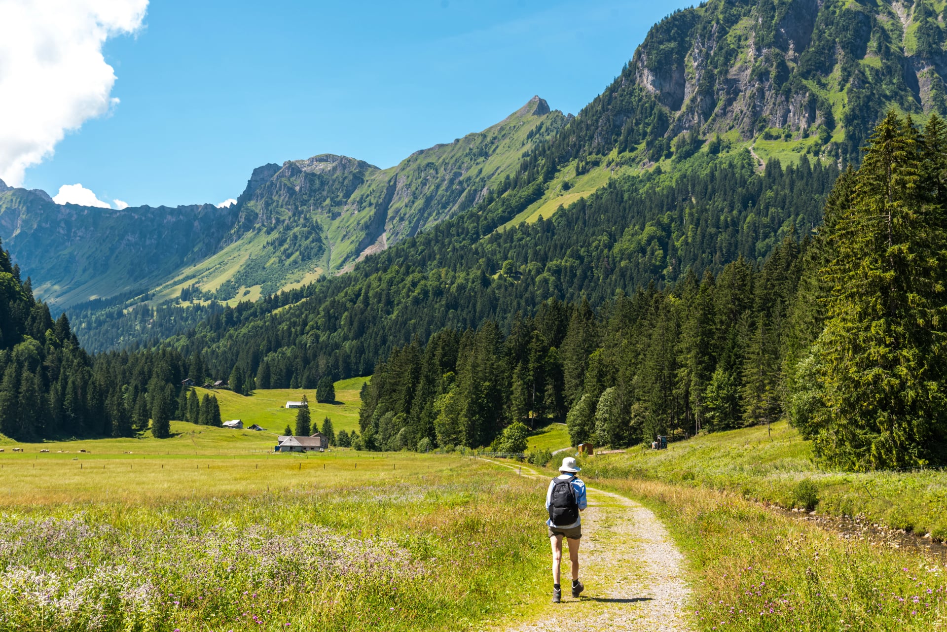
What sets the swiss via alpina apart from other great Alpine routes is its breadth. In 18 days it carries you through German-speaking eastern Switzerland, the French-German borderland of the Bernese Oberland, and into the French-speaking Vaud Alps before finishing on the shores of Lake Geneva. The culture, architecture, cuisine, and even the light changes visibly as you walk west. No other trail in Switzerland captures that transformation.

Where Does the Via Alpina Route Go?
The via alpina route runs roughly 390 km east to west, from the Rhine Valley town of Sargans — set between the Swiss-Liechtenstein border and the Glarner Alps — all the way to Montreux on the eastern shore of Lake Geneva. It does so in four broadly distinct geographic chapters.
Eastern Alps — Stages 1–5 (Sargans to Altdorf)
The route opens in quieter, less tourist-heavy terrain. You cross the first passes through the Glarus Alps — Foopass (2,223 m) and Richetlipass (2,261 m) — and walk through the Swiss Tectonic Arena Sardona, a UNESCO World Heritage geological site. The villages here feel local and unhurried. Stage 4 passes Urnerboden, the largest alp in Switzerland with around 1,200 cows on summer pasture. Stage 5 descends to Altdorf, the town of the William Tell legend, via the powerful Staubifall waterfall.

Central Alps — Stages 6–8 (Altdorf to Meiringen)
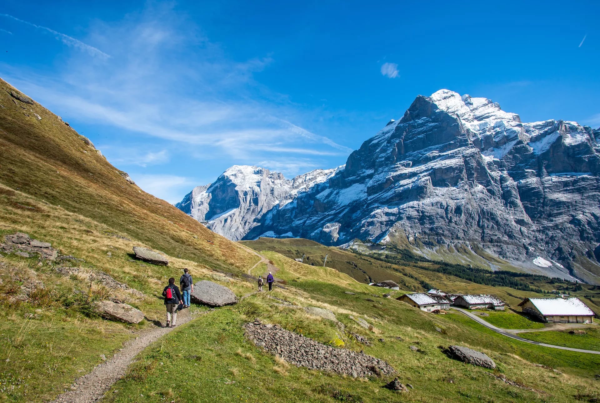
Stage 6, from Altdorf to Engelberg, is the route's longest and hardest single day: 30 km and 1,900 m of ascent over the Surenenpass (2,291 m). From Engelberg — home to the Titlis glacier — the trail eases into the Bernese highlands via Jochpass (2,207 m) and the high-altitude hotel at Engstlenalp, before a long descent into Meiringen.

Bernese Oberland — Stages 9–15 (Meiringen to Lenk)
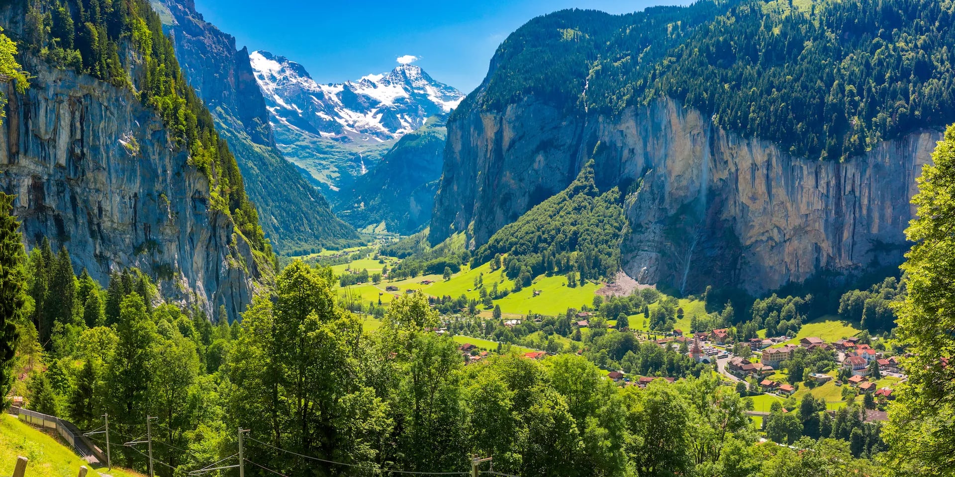
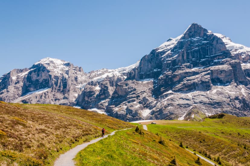
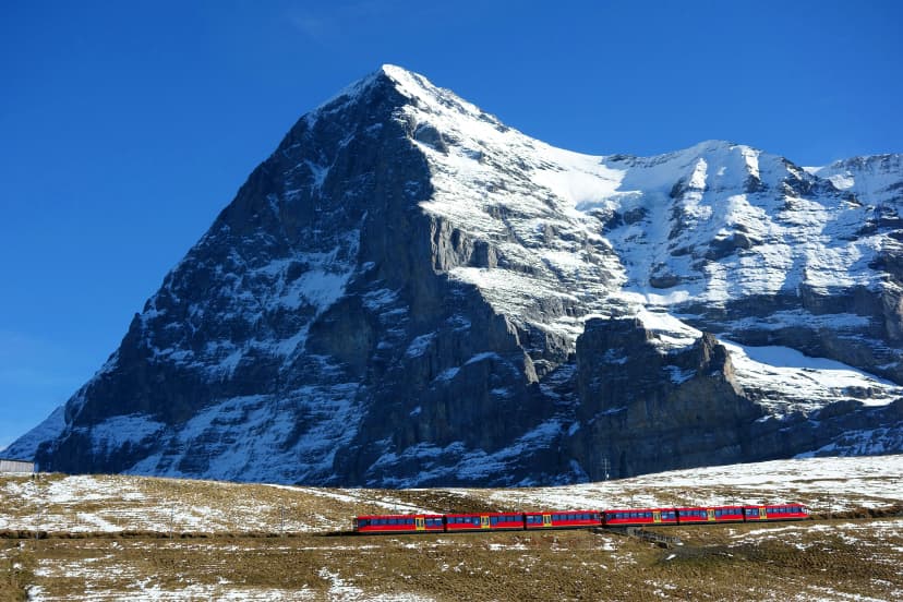
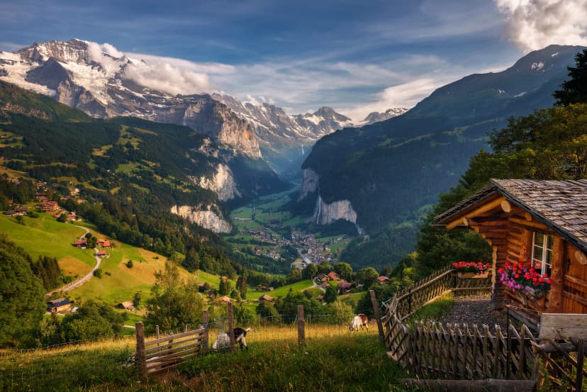
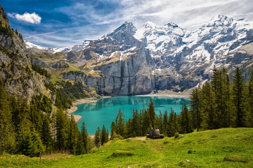
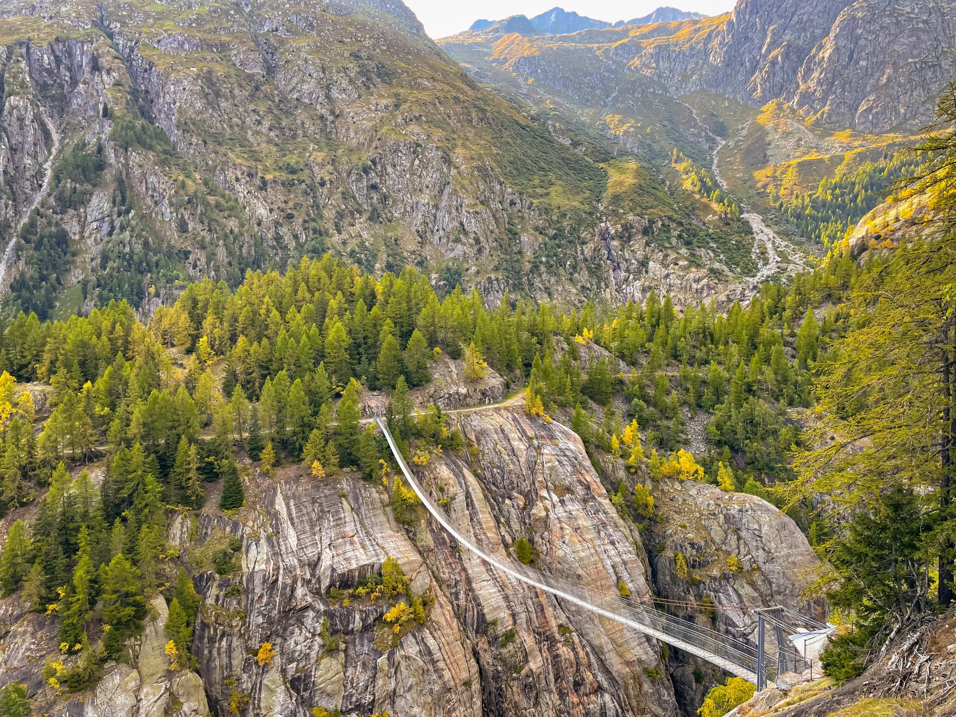
This is the visual and emotional centrepiece of the via alpina trail. Grindelwald, Kleine Scheidegg, the Eiger North Face, Wengen, Lauterbrunnen Valley, the car-free village of Mürren, the route's highest crossing at Hohtürli Pass (2,778 m), the turquoise Oeschinnensee lake above Kandersteg, the resort town of Adelboden. This block — stages 9 through 15 — forms the Via Alpina Bear Trek, covered in its own section below.

French-Swiss Alps — Stages 16–18 (Lenk to Montreux)
The final chapter shifts in character. The trail crosses into French-speaking Switzerland near Château-d'Oex, where you can taste L'Etivaz cheese from its AOC-protected production village. The Col de Chaude serves as the last pass, and the ridge at Rochers de Naye (2,042 m) delivers a final panorama of Lake Geneva, with both the Jungfrau and Mont Blanc massifs visible on a clear day. The descent into Montreux, with its Mediterranean micro-climate and lakeside Château de Chillon, is one of the most satisfying arrivals in long-distance hiking.

Via Alpina Stage Overview
The table below gives you an at-a-glance planning tool for all 18 stages. Distance and elevation gain are approximate — exact figures depend on the precise variant walked.
Stage | From → To | Distance | Elev. Gain | Character |
1 | Sargans → Weisstannen | 14 km | 650 m | Gentle warm-up; no pass |
2 | Weisstannen → Elm | 23 km | 1,250 m | First pass: Foopass (2,223 m) |
3 | Elm → Linthal | 24 km | 1,450 m | Tectonic Arena Sardona; Richetlipass |
4 | Linthal → Klausenpass | 17 km | 1,300 m | Urnerboden — largest alp in Switzerland |
5 | Klausenpass → Altdorf | 22 km | 1,100 m | Staubifall waterfall; lake descent |
6 | Altdorf → Engelberg | 30 km | 1,900 m | Longest day; Surenenpass (2,291 m) |
7 | Engelberg → Engstlenalp | 11 km | 1,250 m | Jochpass (2,207 m); remote hut night |
8 | Engstlenalp → Meiringen | 20 km | 650 m | Jungfrau massif views; long descent |
9 | Meiringen → Grindelwald | 22 km | 1,400 m | Grosse Scheidegg; Reichenbach Falls |
10 | Grindelwald → Wengen | 19 km | 1,200 m | Eiger North Face; Kleine Scheidegg |
11 | Wengen → Mürren | 9 km | 850 m | Easy forest traverse; car-free village |
12 | Mürren → Griesalp | 17 km | 1,100 m | Sefinenfurgge (2,612 m); rocky descent |
13 | Griesalp → Kandersteg | 16 km | 1,400 m | Hohtürli Pass (2,778 m) — route's highest |
14 | Kandersteg → Adelboden | 17 km | 1,350 m | Bunderchrinde Pass (2,385 m) |
15 | Adelboden → Lenk | 20 km | 950 m | Hahnenmoospass; gentler terrain |
16 | Lenk → Gstaad | 23 km | 1,150 m | Trüttlisbergpass; sheep pastures |
17 | Gstaad → Château-d'Oex | 26 km | 1,500 m | Language border crossing; L'Etivaz cheese |
18 | Château-d'Oex → Montreux | 21–33 km | 1,860 m | Col de Chaude; Lake Geneva finale |
Stages 9–15 form the Via Alpina Bear Trek — the Bernese Oberland highlight block from Meiringen to Lenk. Several stages across the full route can be shortened using cable cars or public transport, particularly stages 6, 8, 11, and 18.
Want to know exactly how a typical day on the trail unfolds — from morning departure to arrival at your accommodation? Make sure to check our breakdown of what a typical day looks like when hiking in Switzerland.

Route Highlights
The Via Alpina trail passes through some of the most remarkable landscapes in the Alps. These five highlights stand out across the full route — each one worthy of the journey on its own.
The Via Alpina Bear Trek — The Best Section in 9 Days
Not everyone has three weeks to commit to the full alpine pass route Switzerland. For those who want the most scenic days on the via alpina switzerland without starting from Sargans, the Via Alpina Bear Trek is the answer.
The Bear Trek is a 9-day, 8-night route through the heart of the Bernese Oberland, running from Meiringen through Grindelwald, Wengen, Mürren, Kandersteg, and Adelboden to Lenk. It covers stages 9–15 of the full route — the same section that most hikers, when asked, identify as the most extraordinary stretch of the via alpina green trail.
The name doesn't promise wildlife encounters. It refers to a historic bear trail once used by bears and wolves that carved the original path through the Bernese Alps over centuries. What it does promise is concentrated excellence: every day from Meiringen onward passes through scenically significant terrain.

You hike below the Eiger, Mönch, and Jungfrau. You traverse Lauterbrunnen's waterfall valley. You cross the route's two highest passes — Sefinenfurgge (2,612 m) and Hohtürli (2,778 m). You arrive at Oeschinnensee. It is, by any measure, the best 9 days Switzerland has to offer on foot.
How does the Bear Trek compare to the full Via Alpina?
Via Alpina (Full) | Via Alpina Bear Trek | |
Duration | 18 days | 9 days |
Distance | ~390 km | ~150 km |
Technical | 3/5 | 3/5 |
Fitness | 5/5 | 4/5 |
Highest pass | 2,778 m | 2,778 m |
Starts | Sargans | Meiringen |
Finishes | Montreux | Lenk |
Best for | Full Swiss traverse | Best-of Bernese Oberland |
The Bear Trek has a lower fitness threshold (4/5 vs 5/5) and a more manageable time commitment, making it an ideal choice for those doing their first multi-week Alpine hike or working with a shorter holiday window. The Hohtürli stage is equally demanding whichever version of the trail you're on — but the shorter overall duration means your body is fresher on each individual day.

Both tours are self-guided: accommodations booked, luggage transferred between stops, and GPS routes provided before departure. All that remains is the hiking.
Visit our accommodation guide to see what you can expect from your overnight stays on the way.
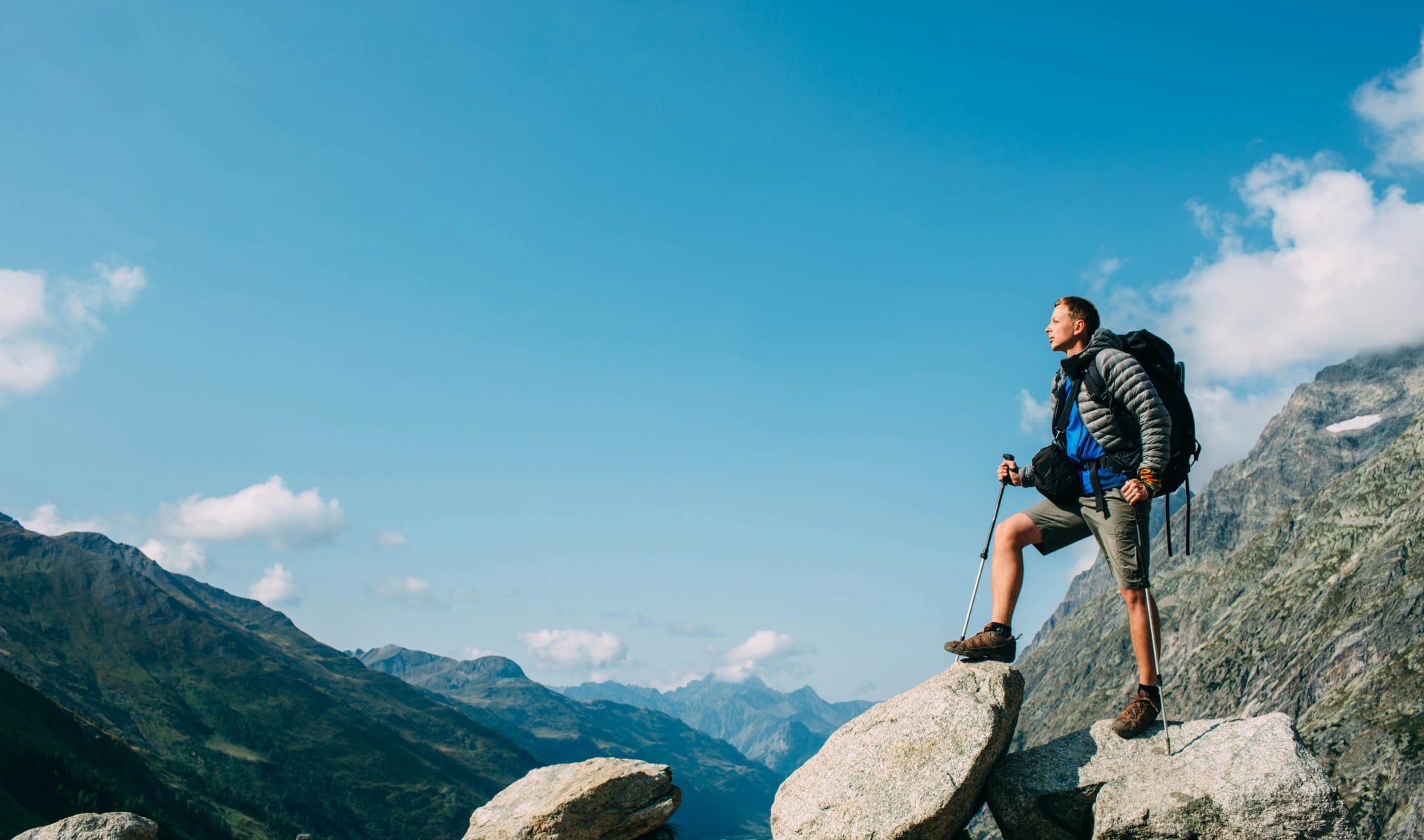
How Difficult Is the Via Alpina?
The Swiss Via Alpina sits in the moderate-to-challenging range. It is harder than the Tour du Mont Blanc in terms of daily output, comparable in fitness demands to the Walker's Haute Route, but slightly less technical than the latter on exposed and scrambling terrain.
Technical difficulty Breakdown
The route is a hike throughout — no climbing equipment required, no via ferrata sections. What the technical rating reflects is the variety of terrain. Loose scree on pass descents, some exposed ridge sections requiring a confident head for heights, and the kind of uneven rocky trail surface where an inattentive step turns an ankle. Trail marking is consistent and reliable: red and white alpine blazes on mountain terrain, yellow directional signs in valleys. Navigation rarely requires more than attention and a GPS backup.
Fitness Level Breakdown
This is where the trail earns its top rating. The challenge is not any single day but the accumulation of 18 consecutive days averaging 21 km and 1,200 m of ascent. Stages vary considerably — Stage 11 (Wengen to Mürren) is 9 km with 850 m gain; Stage 6 (Altdorf to Engelberg) is 30 km with 1,900 m gain. A useful benchmark: if you can comfortably hike 20 km with 1,000–1,200 m of ascent without significant next-day fatigue, and repeat that on consecutive days, you have the fitness foundation needed.
Who it suits: Experienced day hikers and those who have completed at least one previous multi-day route. Not recommended as a first-ever multi-day hike without solid preparation.
When to Hike the Via Alpina
For the full month-by-month picture of Swiss alpine conditions, our seasonal hiking guide covers every month from June through October.
The standard hiking season is mid-July to end of September, though conditions vary by year depending on winter snowfall. Here is what each month offers:
Month | Conditions | Practical Notes |
June | Lower stages open; high passes likely snow-covered | Not recommended above 2,500 m without experience in snow travel |
Early July | Season opening in normal snow years | Some patches on shadowed pass sections; possible on full route from mid-July onward |
August | Peak season; warmest temperatures (25–30°C possible above 2,000 m) | Afternoon thunderstorms common; cross passes before noon; book 6–8 weeks ahead |
September | Most stable conditions; crisp mornings | Quieter on trail; huts begin closing in the final week; recommended for experienced hikers |
October | Risky; most huts closed | Wild camping tolerated above treeline in undamaged areas; first heavy snow likely |
The afternoon storm pattern in July and August is worth taking seriously. Temperatures can drop dramatically within a storm, and even July can bring sudden snowfall above 2,500 m. The strategy is simple: be over the high passes by midday, and descend before weather builds in the afternoon valley heat. If you are in doubt about daily conditions before hitting a pass, check the Switzerland Tourism weather resources or local hut advice the evening before.

For a more detailed look at seasonal conditions and what to expect month by month on Swiss trails, see our weather guide.
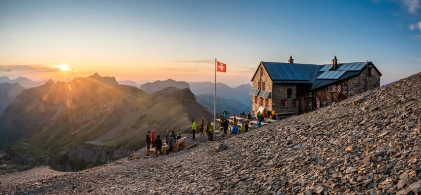
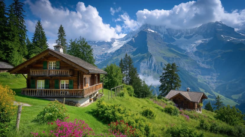
Accommodation on the Via Alpina
One of the advantages of the alpine pass route over purely hut-based routes is that most stages end in valley villages, giving you a wider range of accommodation options and more comfortable sleeping on average.
The SAC huts on the Via Alpina work the same way as those on the Haute Route — our guide to huts on the Haute Route explains the communal living, cash payments, and booking approach.
Booking Strategy
For July and August, book a minimum of 6–8 weeks ahead. The Bernese Oberland stages — Grindelwald, Wengen, and Mürren especially — fill earliest due to high general tourism traffic in those villages. September is more flexible, but huts begin closing in the final week of the month, so check individual opening dates. Browse and book via the SAC hut finder.
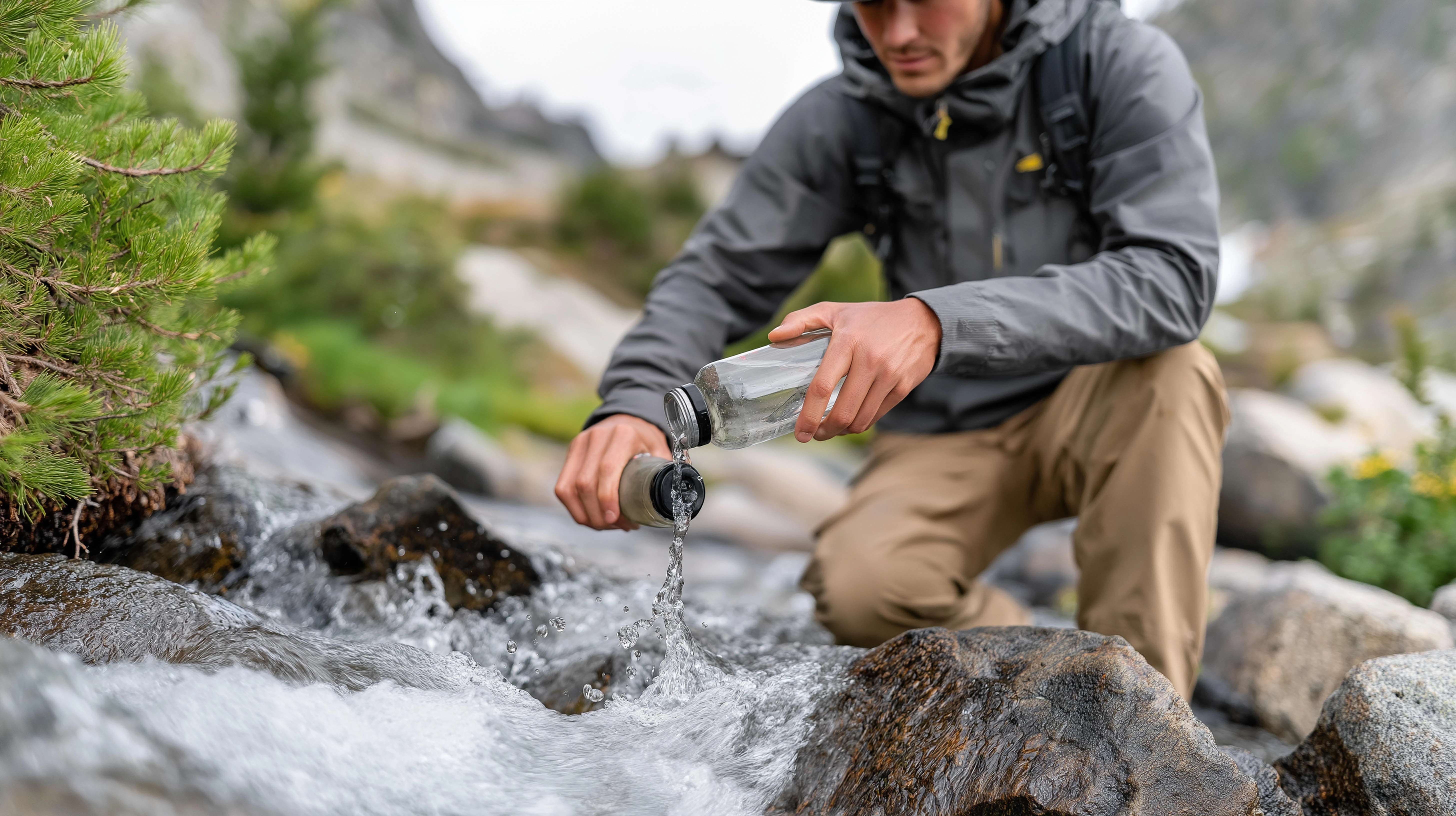
Water
Streams are plentiful along the route. A portable water filter is the most practical solution for refilling on the go — it is lighter than carrying sufficient water and cheaper than buying bottled at huts. Below alpine pastures with grazing cattle, filter before drinking.
Trail Marking
The Via Alpina is an entirely different proposition from the Haute Route in this respect — it stays within Switzerland from start to finish, so there is no country border to navigate and no system switch mid-route. What it has instead is its own layer of branded route marking sitting on top of the standard Swiss national system, which creates a slightly different reading challenge: knowing when you are following the Via Alpina specifically versus the underlying Swiss trail network it shares terrain with.
Trail marking on the Via Alpina Switzerland is built on the Swiss national waymarking system throughout — consistent, well-maintained, and logical once you understand the colour hierarchy. What distinguishes the Via Alpina from a standard Swiss trail is its own branded route markers, which overlay the national system and confirm you are on the correct line of the 18-stage traverse rather than simply on a Swiss path that happens to head in the same direction.
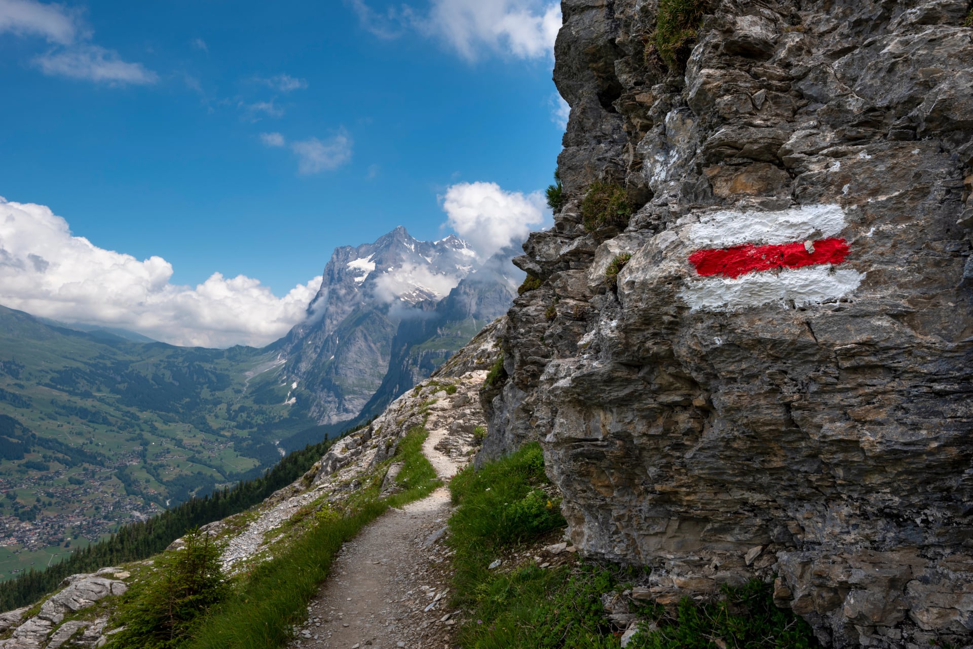
Three marking types appear repeatedly across all 18 stages, and understanding the relationship between them — rather than treating each as a separate system — is the key to navigating the route confidently.
One structural note: unlike the Haute Route, the Via Alpina does not use blue-white-blue markers (T4+) on any of its standard 18 stages — the route is deliberately designed to avoid terrain requiring that grade. If a stage variation takes you onto T4 ground, that is an off-route choice rather than a waymarked section of the traverse.
Getting There & Getting Back
Starting at Sargans (full Via Alpina): The easiest approach is via Zurich. Direct trains from Zurich Hauptbahnhof reach Sargans in 75 minutes. From Zurich Airport, take the S-Bahn to Zurich HB and connect from there. Private airport transfers to Sargans can be arranged when booking a tour.
Starting at Meiringen (Bear Trek)
Train connections from Zurich (~1.5 hrs) or Interlaken (~40 min). Well-connected by Swiss public transport throughout the year.
Finishing at Montreux
Direct trains connect Montreux to Geneva (1 hour), Zurich (2.5 hours), and multiple international rail hubs, making post-hike city stopovers easy to organise.

Schedules and Tickets:
SBB (Swiss Federal Railways) — The one booking tool you’ll actually use for Zürich HB → Sargans, Zürich → Meiringen, and Montreux → Geneva/Zurich with live platform info and disruption updates
ZVV (Zürich Transport Network) — Best for short Zürich-region legs (especially Zürich Airport ↔ Zürich HB) when you want local S-Bahn frequencies and stop-by-stop details
Luggage transfer
On both of our self-guided Via Alpina tours, bags are transported between accommodations daily. You hike with a daypack containing only your essentials — water, snacks, layers, and rain gear. The full bag meets you at each night's accommodation.
Training & What to Pack
Training
The Via Alpina rewards preparation. The hikers who suffer least are not necessarily the strongest — they are the ones who arrived knowing what 18 consecutive days of hiking feels like in the body.
The packing principles are similar to the Haute Route — see our Haute Route packing list for a detailed gear breakdown that applies to both routes.
Fitness benchmark: Before departure, you should be comfortable hiking 20 km with 1,000–1,200 m of gain without significant next-day fatigue. More important than any single big day is the ability to repeat moderate efforts day after day. Build towards back-to-back hiking days in the weeks before you leave — even two consecutive days of 15 km each will teach your legs more than one 30 km effort.

Footwear: Break your boots or shoes over at least 3–4 hikes before the trail. Blisters on day two are avoidable; they are almost always a failure of preparation rather than equipment. Target pack weight under 9–10 kg — on organised tours, luggage transfer means you only carry a daypack.
For a comprehensive packing list and kit recommendations tailored specifically to Swiss alpine terrain, see our packing guide for hiking in Switzerland.
Packing List
Core gear
Hiking shoes or boots (trail runners work for experienced hikers with strong ankles)
25–40 litre daypack
Hiking poles
Clothing
Base layer top (merino wool recommended for multi-day comfort)
Sports T-shirt for warm days
Mid-layer fleece
Hardshell waterproof jacket (also windproof)
Waterproof trousers
Hiking shorts + long hiking pants
Comfortable evening clothes for huts and hotels
Down jacket (essential in September)
Warm hat, sun cap, gloves
Hiking socks (bring 3–4 pairs minimum)
Essentials
Sunglasses and high-SPF sunscreen
Water bottle + portable water filter
Blister plasters and small first aid kit
Sleeping liner (huts provide blankets; a liner keeps things hygienic)
Headlamp
ID card or passport
Cash in Swiss francs (CHF) — cards are not always accepted in mountain huts
Snacks for on-trail energy

Lightweight essentials like water filters and high-SPF sunscreen keep you moving comfortablyFAQ
Q: Do I need mountaineering experience for the Via Alpina?
A: No. The via alpina trail is a hike throughout — no ropes, technical climbing, or glacier travel required. What you do need is solid mountain experience, comfort on uneven terrain, and a good head for heights on the handful of exposed sections near the higher passes.
Q: Can I hike just part of the Via Alpina Switzerland?
A: Yes. The route naturally divides into sections of varying length. The most popular standalone option is the Bear Trek (stages 9–15, Meiringen to Lenk, 9 days), which covers the Bernese Oberland highlights. Other sections — the eastern Alps (stages 1–5) or the French-Swiss finish (stages 16–18) — also work as standalone trips with appropriate planning.
Q: How does the Via Alpina compare to the Walker's Haute Route?
A: The Walker's Haute Route (Chamonix to Zermatt, 14 days) is more concentrated, sits at higher average altitude, and is slightly more technical (4/5 vs 3/5). The Via Alpina is longer, more diverse in landscape and culture, and gives you the full east-west sweep of Switzerland. If you want concentrated high-alpine drama around the great 4,000 m peaks, the Haute Route wins. If you want the full breadth of the country, the Via Alpina is your route.
Q: How far in advance should I book?
A: For July and August, plan to book at least 6–8 weeks ahead. The Bernese Oberland stages fill earliest due to the high general demand for accommodation in Grindelwald, Wengen, and Mürren. September allows more flexibility, though the most popular mountain huts book out regardless of month.
Q: Is the Via Alpina suitable for solo hikers?
A: Yes. The swiss alpine pass route is well-marked, most stages end in serviced villages, and emergency services are reliably reachable from any point on the route. Cell reception is variable in valleys but generally available from ridges and passes. Hiking alone on a long-distance trail in Switzerland is common and generally safe with appropriate preparation.
Set Off for Via Alpina Today!
Two routes. Same trail. The question is how much of it you want.
The Via Alpina Switzerland — all 18 stages, 14 passes, Sargans to Montreux — is one of Europe's great long-distance hikes. It is the most complete way to understand what Switzerland is as a landscape and a culture.
The Via Alpina Bear Trek takes the best 9 days from that journey — the Bernese Oberland at its most spectacular, from Meiringen to Lenk — and packages them as a standalone adventure that fits into a single week of holiday.
Both are fully self-guided: accommodations booked, luggage transferred daily, GPS routes delivered before departure, and 24/7 support available throughout. All you bring is the fitness and the curiosity.
Not sure which suits your timeline or fitness level? Book a free consultation or see our other tours and we'll help you find the right fit.


Hassle-Free
We handle itineraries, accommodations, and anything else you prefer not to deal with, so you can enjoy a carefree hike.

Book with confidence
We are a financially protected company, fully bonded and insured, keeping your money safe and allowing you to travel with confidence.

Tried & Tested Adventures
Only the best hut to hut hikes of Switzerland, cherry-picked by our local team with an in-depth knowledge of the region.

Unbeatable support
Our 24/7 customer support is where we show our passion, bringing you a better experience by making your well-being our number one priority.