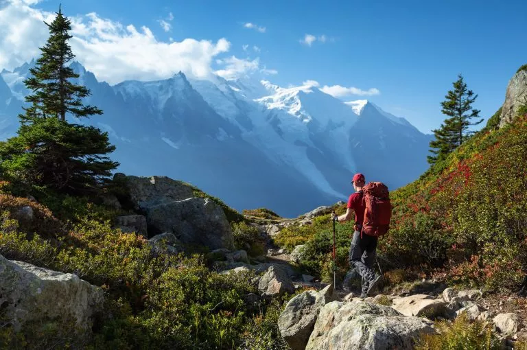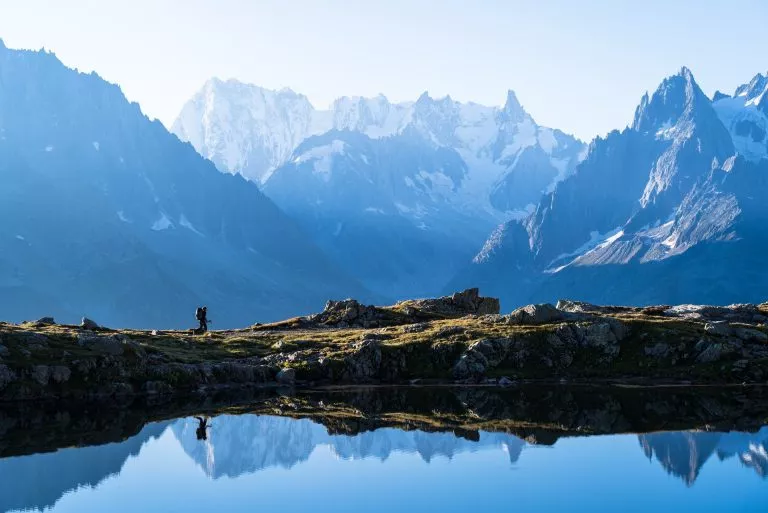


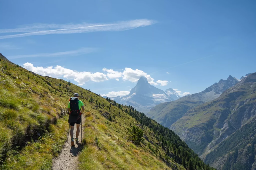
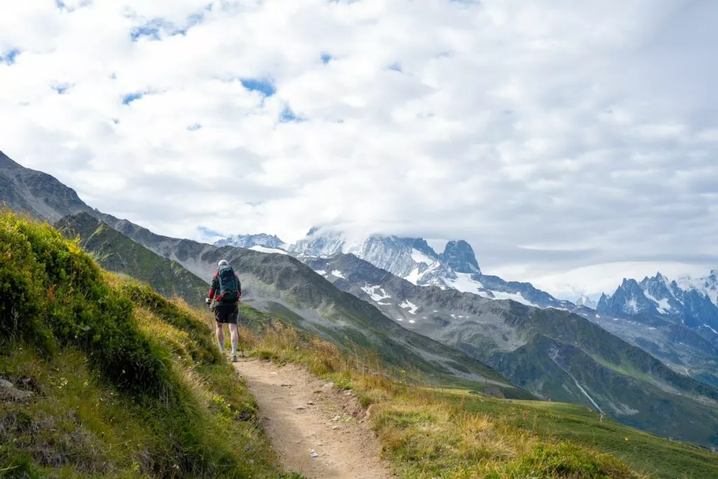
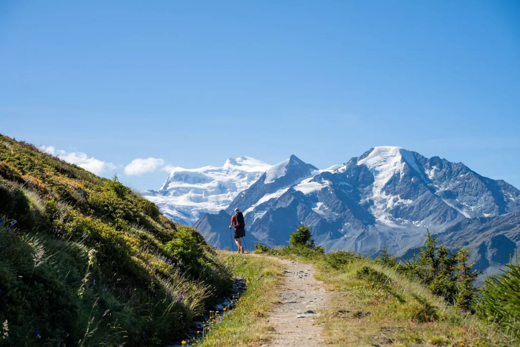
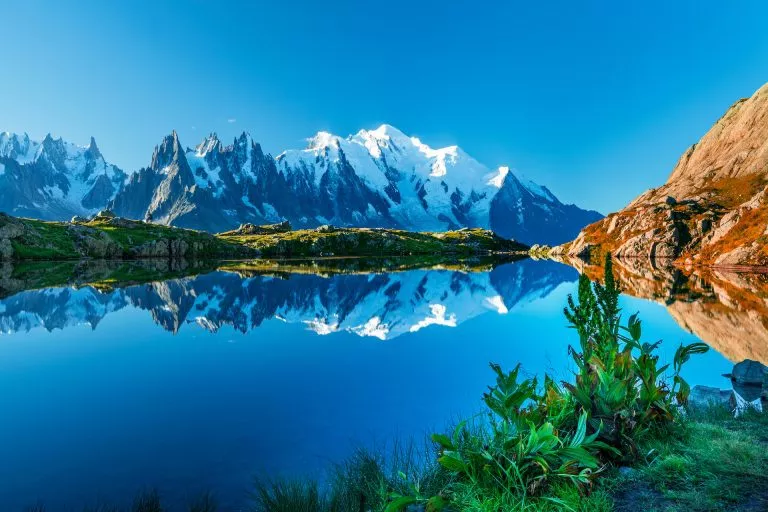
The Walker’s Haute Route is a legendary long-distance hike in Switzerland and France. It takes you from the two most significant mountaineering centers in the world, Chamonix to Zermatt, walking below some of the most imposing 4000 m peaks in the Alps and visiting its most scenic valleys.
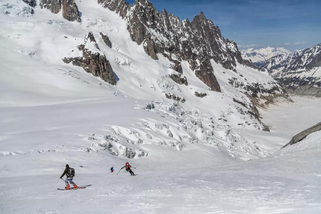
It is one of the most scenic trekking routes in the world. Although the original route across the glaciers is already iconic with ski-touring enthusiasts, it is gaining popularity among hikers very fast.
For now, it is still much less crowded than the famous counterpart of Tour du Mont Blanc — but its rugged, wilder and even more epic scenery might soon put it in the #1 spot of long-distance hikes in the Alps.
With the glaciers slowly disappearing because of climate change, now is the perfect time to still experience it.
Where does the Walker’s Haute Route go?
As previously mentioned, the Walker’s Haute Route leads from Chamonix in France to Zermatt in Switzerland. It has 14 stages in which it crosses over 11 mountain passes. The path from west to east is about 200 kilometers long, and around 15,000 meters of elevation gain, depending on which alternative routes you choose.
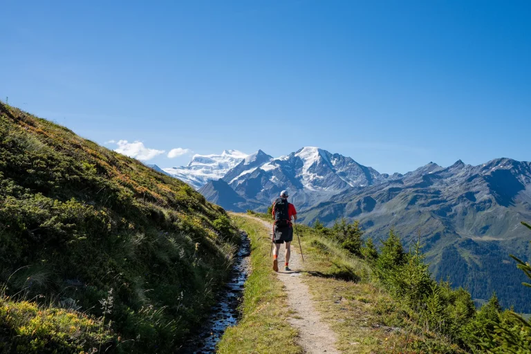
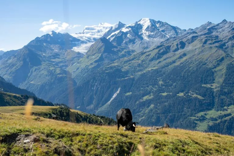
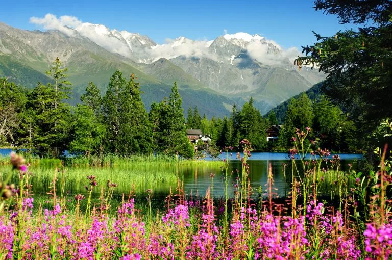
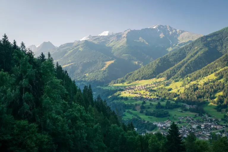
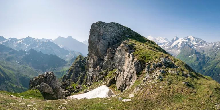
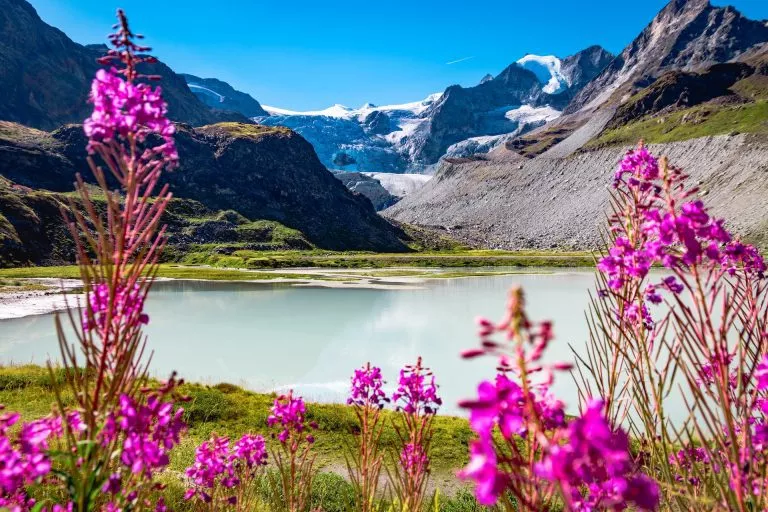
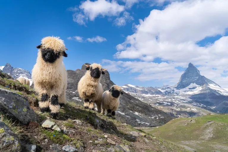
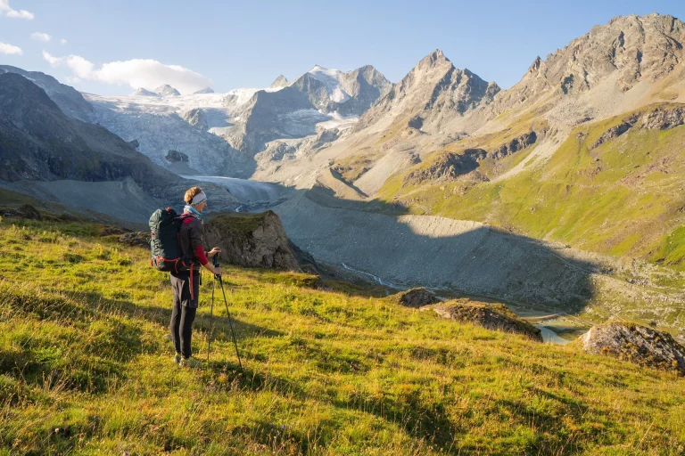
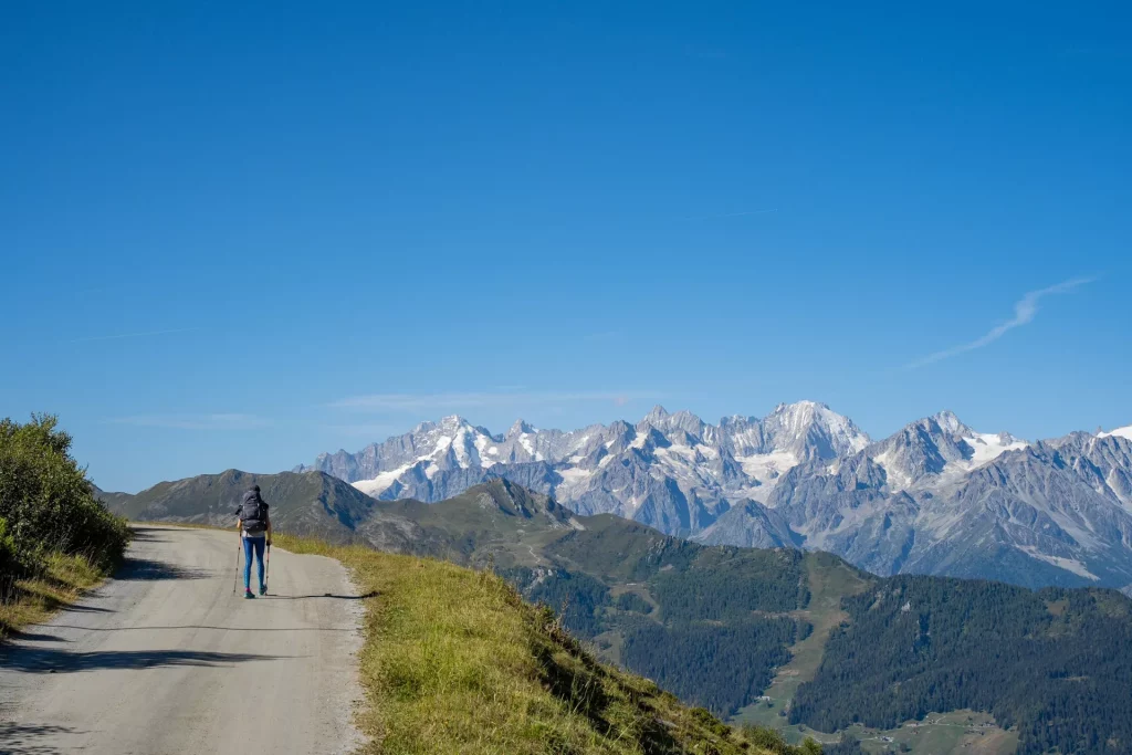
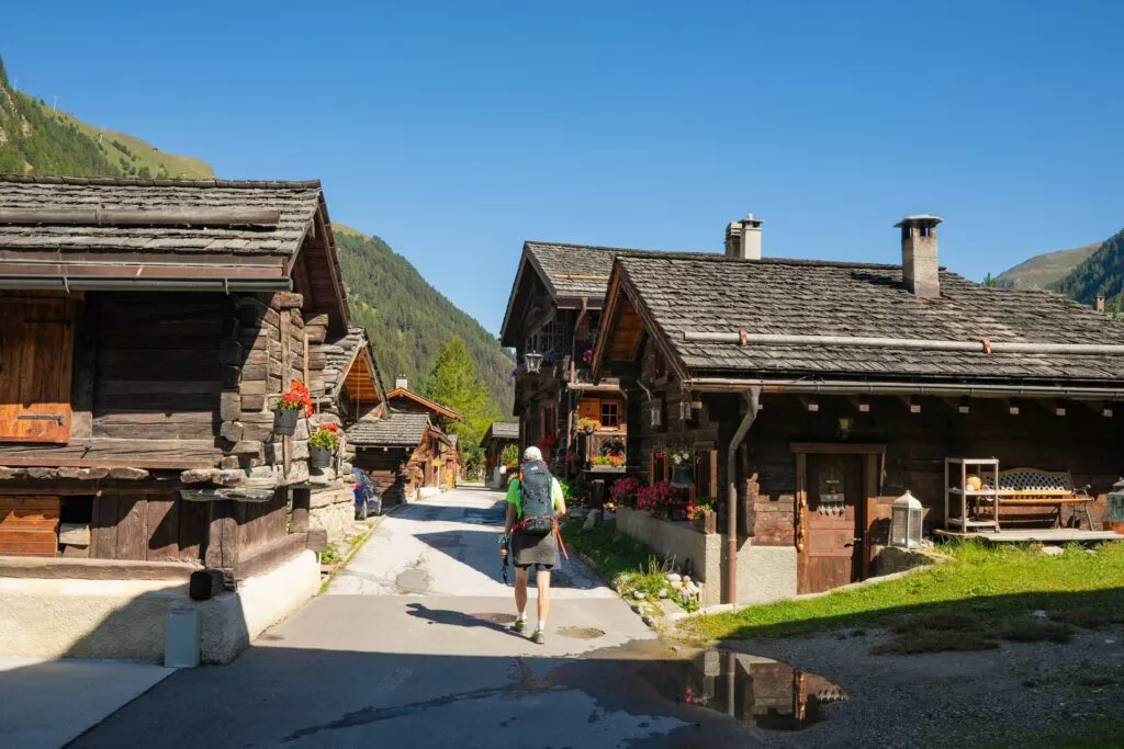
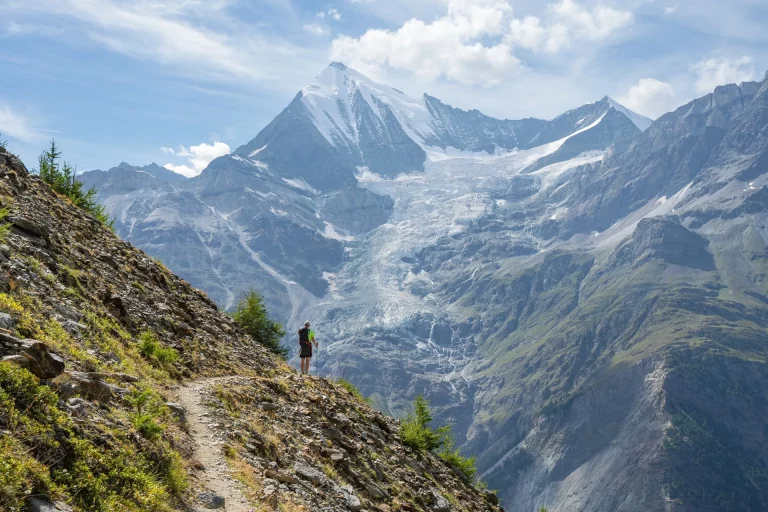
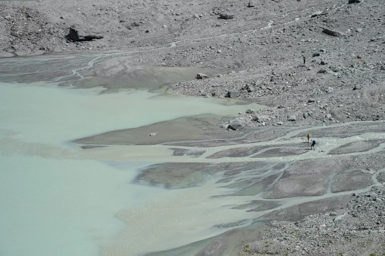
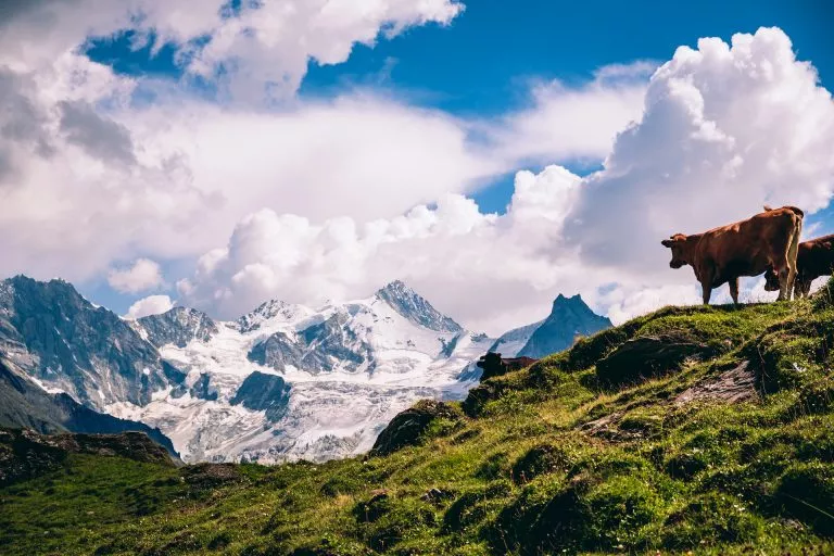
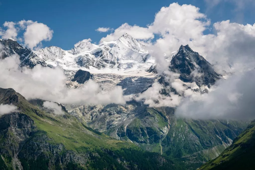
You will pass through many different landscapes during your hike: from lush green meadows with picturesque alpine villages to snow-covered glaciers below imposing peaks. If you’re lucky, you might even see wildlife such as ibexes, chamois, and marmots.
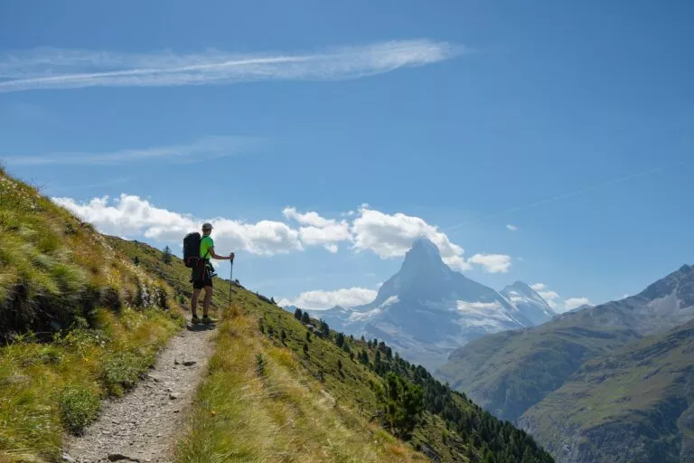
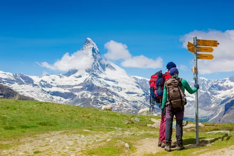
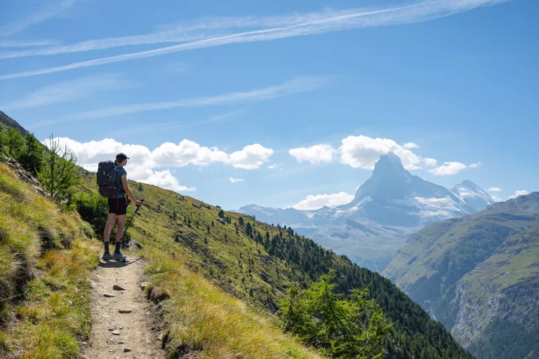
It first goes through the valleys and mountain passes on the north of the Mont Blanc massif. There it enters Switzerland and the Pennine Alps, crossing their northern half until the Mattertal, where it joins the Europaweg trail, ending with spectacular views over the iconic Matterhorn peak.
Explore the 3D representation below to get a better sense of the whole route and its epic surroundings.
There isn’t just one Haute Route
This “Haute Route” part of the name is in French, and it means the High Route. It has “Walker’s” in front of it to distinguish it from the original mountaineering route, also called the Classic Haute Route.
The Classic Haute Route was first completed in 1860 as a summer mountaineering route by the British Alpine Club, crossing many glaciers from Chamonix to Zermatt. At that time, it was named the High Level Route.
But in 1911, it was first completed on skis. Because the team was French-speaking, its name got translated, and it soon became the most popular route with ski tourers and ski mountaineers in the world.
In comparison to the Walker’s Haute Route, the Classic Haute Route takes you higher and requires technical equipment and mountaineering skills to complete. But it is shorter since it takes more of a straight line through the mountains.
But that doesn’t take away anything from the grandeur of the hiking route, which is different and similarly presents challenges and rewards to everyone who sets out on it.
How difficult is the Walker’s Haute Route?
The Walker’s Haute Route is the hardest of long-distance trekking routes in the Alps, like the TMB or Via Alpina — both physically and technically.
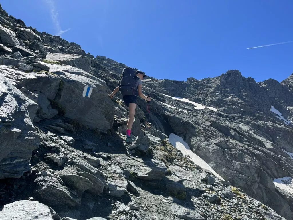
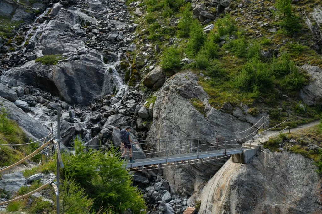
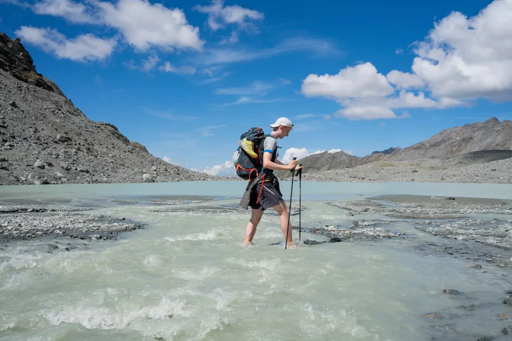
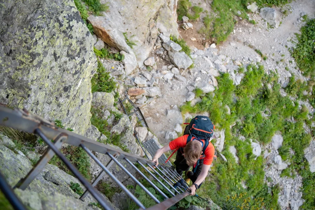
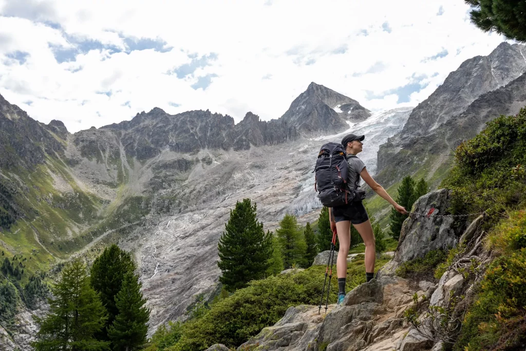
Its mountain passes are higher, and the terrain is trickier, with more rocky descents, challenging for those used to only hiking on hard-pack trails. It also contains some sections with ladders and steel cables, where it is mandatory to use your hands to continue your way.
Here are the various types of terrain you are going to encounter:
1. Hardpack trail
There is almost no hike without these. And on the Walker’s Haute Route, there’s plenty of them too.
Of course, some of them can be much more exposed than others, with some steel cables to help with balance if needed.
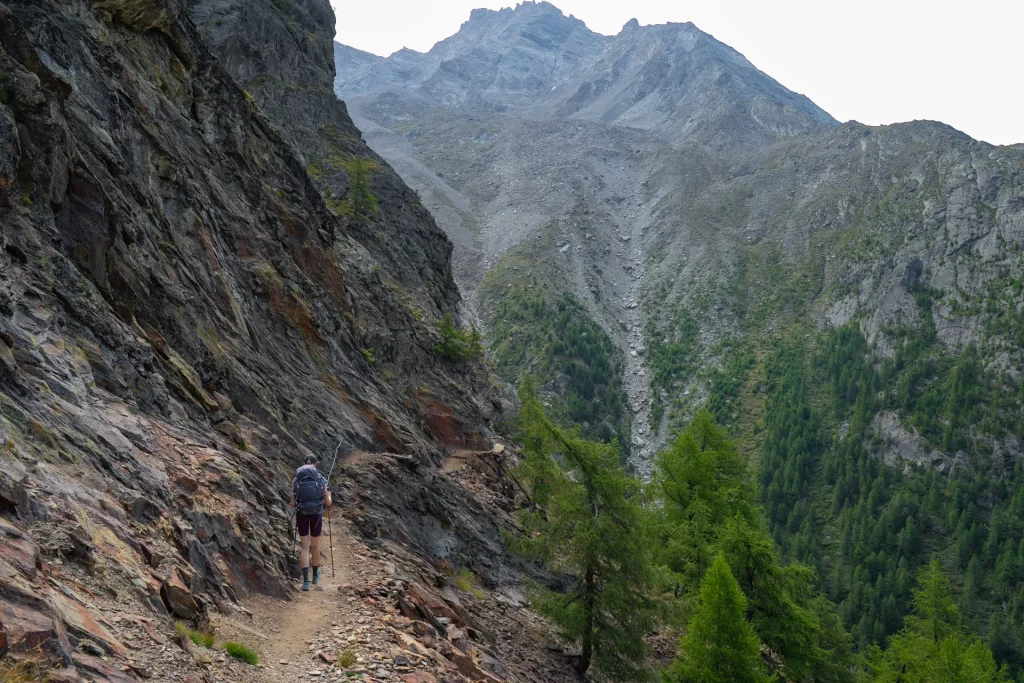
2. Rocky “trails”
These are much more tricky, if you don’t have any prior mountain experience. When tired and not careful, it’s so easy to turn an ankle between one of these granite rocks. They usually occur when hiking to the higher passes or along glacial moraines.
3. Gravel roads
These are more common on some of the ski areas that you are going to cross, especially above Verbier.
4. Asphalt roads
Whenever the trail descends into the valley (and that almost every day), you are going to come to an asphalt road.
5. Bridges
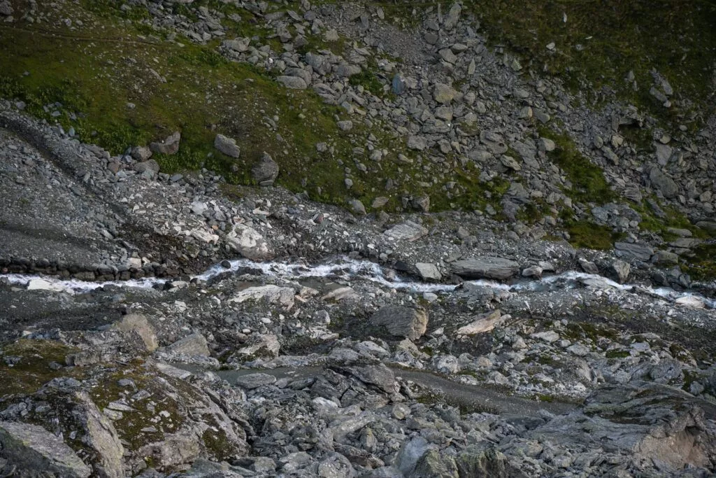
As most of the route goes below mountain peaks with lots of melting snow, it needs to cross many streams of water. Some are small enough so you can jump across, and over some, there are bridges.
And some, you have to cross when you try to take shortcuts.
6. Ladders
There is actually just one section like that, when going up Pas de Chevres (before Arolla), but even one can ruin your hike if you are not fond of heights.
How to get to the starting point?
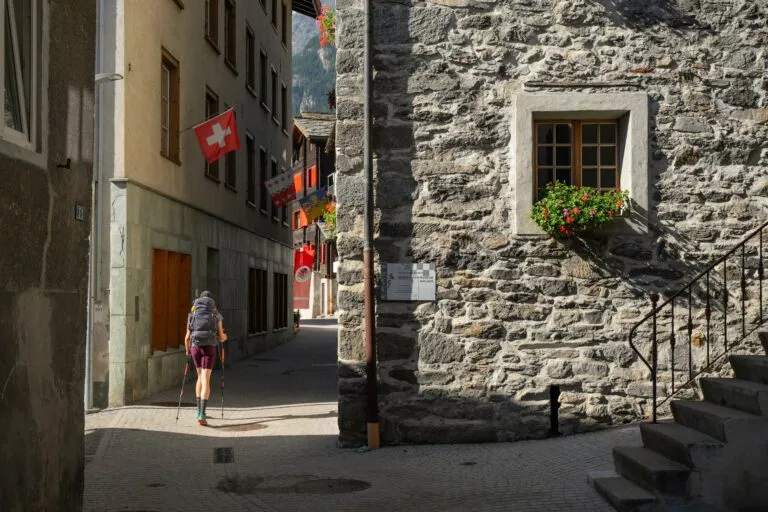
The starting point of the Walker’s Haute Route is Chamonix. It is pretty easy to get there with multiple ways of transportation.
The best way to get here is by plane. Geneva International Airport (GVA) is just 103km away from Chamonix and has direct flights from most major European cities.
From there, you can get to Chamonix by bus, train or shuttle. Bus usually takes around 1h40min and costs from 15 to 20 Euros.
Trains are quite slower and require many changes in between, taking you at least 2h40min to get there.
The most comfortable and fastest way to get to Chamonix is by shuttle, taking about 75 minutes.
And there, your hike begins.
Walker’s Haute Route Itinerary
Here is a quick overview of the standard Walker’s Haute Route itinerary, along with some alternatives, if you want to prolong your hike or see something a little bit different.
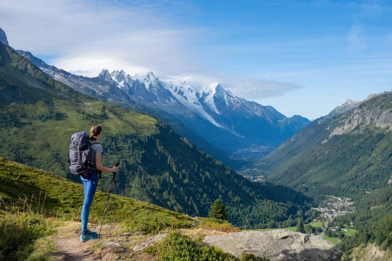
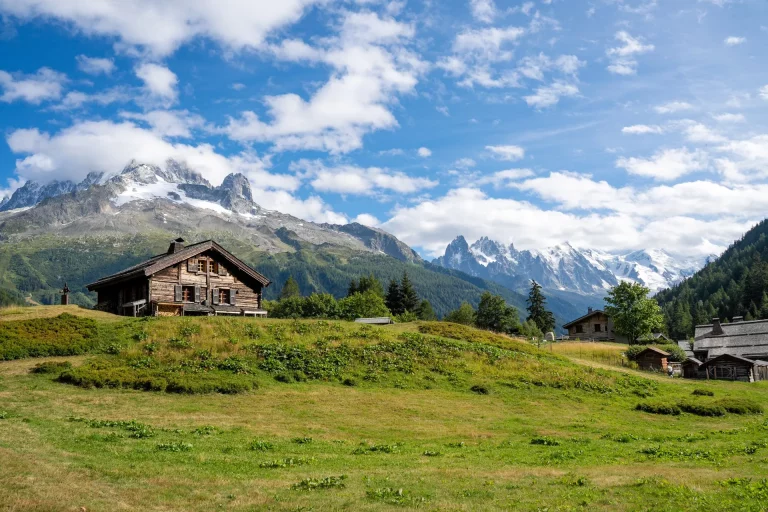
Day 1 – Chamonix to Argentiere: Ease into your adventure with a scenic hike to Lac Blanc. Enjoy breathtaking views of Mont Blanc before descending to Argentiere. For a gentler start, opt for the direct trail along the valley.
Day 2 – Argentiere to Trient: Savour your last moments in France with a leisurely trek along Aiguillette des Possettes to the Swiss border at Col de Balme, then descend into Trient.
Day 3 – Trient to Champex: Brace yourself for a thrilling climb over Fenetre d’Arpette, offering stunning glacier views. The route then mellows into a pleasant walk to Champex-Lac.
Day 4 – Champex to Le Châble: Enjoy the Swiss countryside, strolling through Val Ferret and along the river to Le Châble.
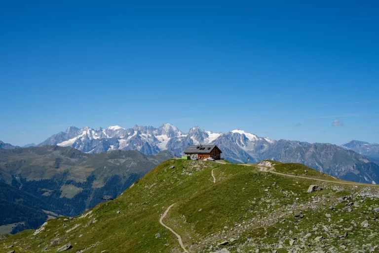
Day 5 – Le Châble to Cabane du Mont Fort: Prepare for a steep ascent through Verbier’s ski slopes, rewarded with views of the Grand Combin before reaching Cabane du Mont Fort.
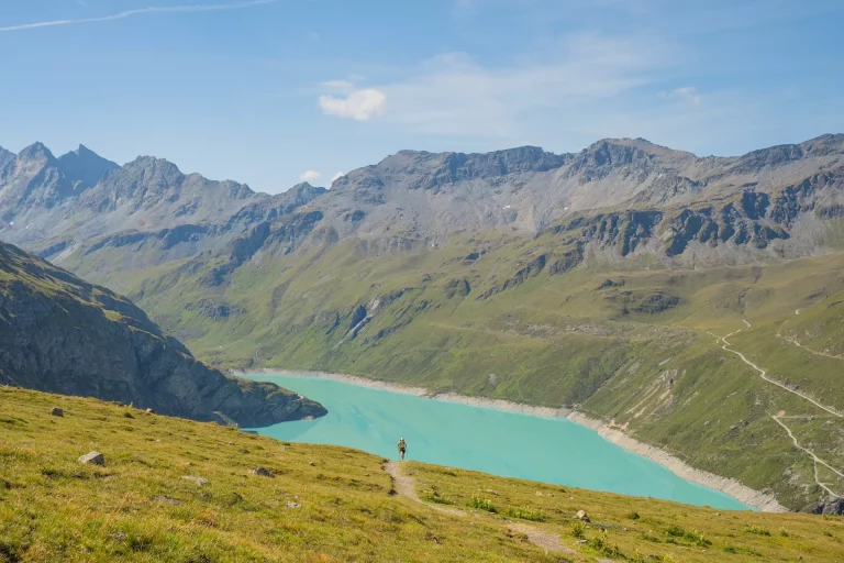
Day 6 – Cabane du Mont Fort to Cabane de Prafleuri: Traverse green ridges and a moonlike plateau, passing the Grand Désert Glacier to reach Cabane de Prafleuri.
Day 7 – Cabane de Prafleuri to Arolla: Hike alongside Lac de Dix and across Glacier de Cheilon, with options to pass through exhilarating trails before descending to Arolla.
Day 8 – Arolla to La Sage: A lighter day awaits, descending from Arolla through charming Swiss villages to La Sage.
Day 9 – La Sage to Cabane de Moiry: Ascend from the valley to Col du Tsate and towards Moiry Glacier. The day ends at the scenic Cabane de Moiry.
Day 10 – Cabane de Moiry to Zinal: Leave the hut for Col de Sorebois, offering panoramic views, then descend to Zinal, with an option for a cable car.
Day 11 – Zinal to Gruben: Venture into the German-speaking part of Switzerland, hiking over Forcletta pass, with an optional detour via Hotel Weisshorn.
Day 12 – Gruben to St Niklaus: Cross the contrasting landscapes of Augstbordpass, then descend to St. Niklaus.
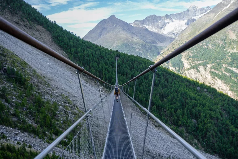
Day 13 – St Niklaus to Europahutte: Start the Europaweg, a majestic hike with views of Matterhorn, ending at Europahutte.
Day 14 – Europahutte to Zermatt: Traverse the stunning Europaweg, cross the world’s longest pedestrian suspension bridge, and descend to Zermatt, marking the journey’s end.
Alternative options on the route
The alternatives below are just some of many. We selected them, because they are the most convenient and beautiful. There are some other options, but they take you much too far from the main trail for our opinion.
Alternative to Day 1: For a less strenuous start, you can follow a gentler trail directly to Argentiere along the valley.
Alternative for Day 2: Instead of climbing directly to Col de Balme, take the route across the Aiguillette de Posettes, a scenic ridge at the north end of the Chamonix valley.
Skip Trient and go straight for Champex-Lac: If you’re a fast hiker, or you slept on the Col de Balme, you can also skip the often fully-booked Trient to go straight to Champex-Lac. Do this by following the Les Grands trail, which takes you to Fenetre d’Arpette pass in a more direct fashion, with amazing views of the Trient Glacier.
Alternative for Day 3: In case of bad weather, opt for the Bovine route, a part of the Tour du Mont Blanc, which offers a less challenging path.
Extra Day between Days 11 and 12: Extend your journey with an overnight stay at the historic Hotel Weisshorn, then hike across Meidpass the following day for breathtaking views and a serene descent to Gruben.
These alternatives provide flexibility in your journey, allowing you to tailor the hike to your preferences and weather conditions.
How to plan your Walker’s Haute Route hike?
With so many options, the Walker’s Haute Route is not easy to plan. You have to decide upon the itinerary, which alternative routes to take, the accommodations you’re gonna stay at, and more.
To make it all easier, we’ve prepared a pre-planned self-guided itinerary with our favorite alternatives already part of it, and some optional.
Check it out below.

If you still wish to plan it yourself, here are a few tips:
- Plan according to your hiking speed and the number of days you have
- Start planning well in advance to have the most options at your disposal — the most popular accommodations can become full
- Check out some of the best alternate routes on the hike, like the Hotel Weisshorn detour in Stage 11, or the Lac Blanc detour in stage 1
- Plan a rest day in between if you want to take it slowly, or have a reserve in case of bad weather
Best time to hike the trail?
The hiking season on any of the treks in the Alps depends heavily on the amount of snow in the previous winter. In a normal year, the season for the Walker’s Haute Route runs from mid-July to the end of September.
Earlier than August, it’s still possible to find snow on the shady sections of the highest passes, but they don’t require special equipment, and there is no avalanche threat. Now, if the winter was very snowy, the path could be very dangerous till the end of July.
Haute Route Conditions by month
Late June to Early July:
- Expect wet conditions with snow at higher altitudes in late June. Snow typically clears from most passes by early July.
- Trails may be snow-covered, posing challenges for early-season hikers.
July:
- A month marked by lush green meadows and vibrant wildflowers. Long days offer extended hiking hours.
- Temperatures are pleasant, but trails at higher elevations can still have snow patches.
- July tends to be less crowded than August, providing a more serene hiking experience.
August:
- Characterized by high temperatures, sometimes reaching 25-30°C above 2000 meters. This is the peak hiking season with a vibrant and social atmosphere.
- Regular afternoon storms are common, necessitating early starts to avoid weather-related disruptions. Sudden temperature drops and even snowfall can occur during severe storms, but these conditions typically resolve quickly with sunshine.
- Late blooming wildflowers, like edelweiss, add to the trail’s allure.
September:
- Weather becomes colder, sometimes reaching freezing temperatures at night. Despite this, it’s a more stable month with consecutive days without rain.
- Quieter trails provide a peaceful hiking experience, ideal for those seeking solitude.
- By the end of September, many mountain huts start closing, leaving only basic winter rooms open, which are unmanned and unlocked.
October:
- Hiking is still possible, but with more challenging conditions including more frequent rain and the possibility of the season’s first heavy snowfall.
- Wild camping above the tree line is an option, as most mountain huts are closed. Hikers should be self-sufficient and well-prepared for rapidly changing weather conditions.
Accommodations
The Walker’s Haute Route accommodations can be found at different points along the way, either high in the mountains or in the villages and towns.
These are the types of accommodations on the Walker’s Haute Route:
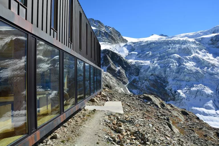
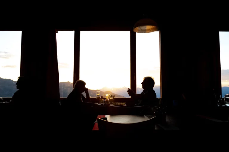
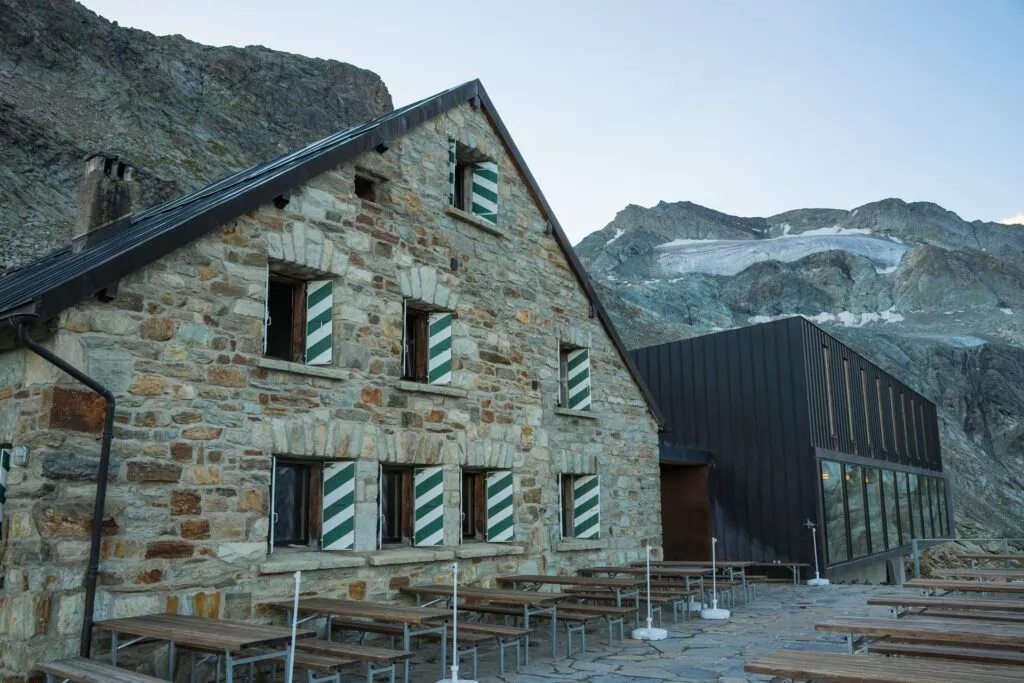
Mountain Huts
They are the highlight of the trail. They are situated in stunning locations on the higher sections of the Walker’s Haute Route. They provide you with a delicious and filling dinner with a basic breakfast at a price similar to a hostel in the valley.
Although they are cozy and well-maintained, the amenities are pretty basic. The beds are in dormitories, except for a couple of private rooms that get booked pretty early. They have shared bathrooms, but hot showers are sometimes not available. Wifi is also available only in some of them.
Some are privately owned, but most are part of the Swiss Alpine Club (SAC). If you are a member (or of any partnering mountaineering club), you can get a discount.
Hotels
Hotels are the most luxurious option on the Walker’s Haute Route, located in towns along the way like Argentiere, Zinal, St. Niklaus, etc. They are small but elegant, catering to hikers and offering them a break from the wilderness. Most of them provide all the usual amenities you would expect from a hotel. Hot showers are most welcome.
Hostels
They are called Gites d’Etape or Auberges, and they are a budget-friendly option for hotels. Rooms are in dormitories with shared bathrooms, but they usually include breakfast and dinner in the price. Of course, as they are mostly in the valley, they have hot showers available.
Water on the trail
Water can be filled up in most accommodations, although some huts do not have drinking water. In that case, you can always buy bottled water, but even better (and cheaper) is to have a water filter with you.
You will also find plenty of streams on the way from which you can fill up, just not if it is below a pasture with cattle, as it might not be drinkable.
How to prepare?
The Walker’s Haute Route is not for couch potatoes. Even if you take your time and go at a leisurely pace, you’ll still need to be ready for many days of hiking with a relatively heavy backpack.
If you want to hike it, you need to be well-prepared for the trail. You should be able to hike at least 10 kilometers and ascend 1,000 meters in elevation without being extra sluggish the next day. Why? You don’t want to feel exhausted by the second day of your trek.
Training
Long-distance hiking is a craft that requires practice. If you don’t start training before your big adventure, you will suffer more than you need to and that means a less pleasant experience.
Why spend all that time struggling to reach the next mountain pass, when you could enjoy the scenery instead?
You need to start hiking regularly. It doesn’t mean you should jump right into very long hikes at first, especially if you haven’t been hiking much before. Instead, build the distance and elevation gain each week.
Near the end of your training, try incorporating two-day hikes (or longer) into your weekend schedule to prepare your body for the rigors of hiking multiple days in a row.
Even if your local hiking trails don’t present the same challenges as long-distance paths or mountain hikes, you can still get a great workout by doing multiple circuits around them.
On your training hikes for the Walker’s Haute Route, wear the backpack you plan to take and pack it as if you were going to do the actual trek. This will help you get used to what feels comfortable and what does not, so you won’t have any surprises on your big hike. Wear your hiking shoes too, so they can break in.
And don’t take the elevator unless you have to. Take the stairs instead!
What to pack?
Pack only what you need to enjoy your hike. Every extra pound will feel like dead weight on your shoulders.
A backpack with 25 to 40 liters of space is the ideal size for most people. Anything larger and you risk packing too much.
When choosing your shoes for the Walker’s Haute Route, it is most important to consider what will work best for your feet. You can choose between either hiking boots or hiking shoes, or sturdier trail-running shoes if you prefer a lighter and more flexible option.
For an average hiker, hiking shoes are still the best choice. They’re sturdy and supportive enough to carry all the extra weight of the backpack, but they’re not as bulky and heavy as boots.
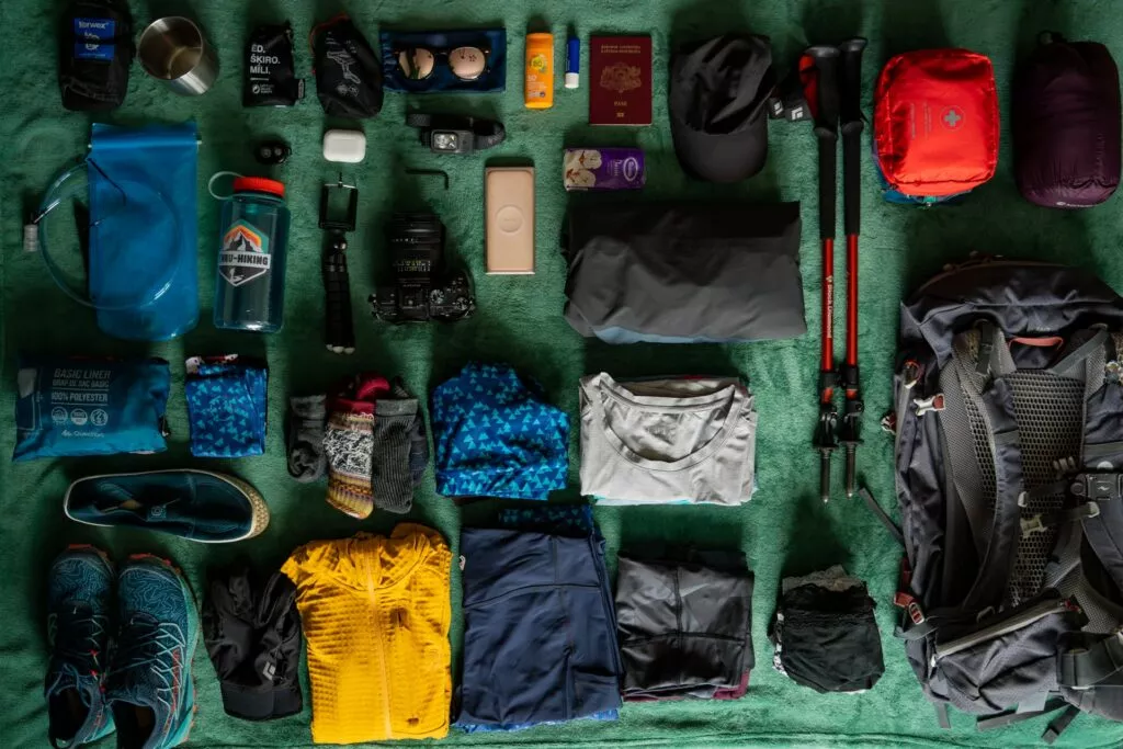
Haute Route Packing list
General
- Hiking shoes/boots
- 25 to 45-liter backpack (depending on the number of days on the trail)
- Hiking poles
Clothes
- Base layer top (we recommend merino wool)
- Sports T-shirt (for the warm days)
- Mid-lay top (like a fleece)
- Hiking shorts (in warmer months)
- Hiking long pants
- Windproof jacket
- Waterproof jacket (not needed if you have a high-quality hardshell which is both windproof and waterproof)
- Waterproof pants
- Comfortable clothes for the evening in huts and hotels
- Warm down jacket (if hiking in colder months)
- Warm hat
- Sun cap
- Gloves
- Hiking socks
Other
- Sunglasses
- Sunscreen
- Small first aid kit
- Water bottle
- Toiletries
- Blister plasters
- ID or passport
- Cash

Where to book?
The above guide will acquaint you with many facets of the Walker’s Haute Route. But that doesn’t mean that you have to be intimidated by planning this adventure.
Booking a self-guided Walker’s Haute Route can save you a lot of time, stress, and hassle. And it’s not even that much more expensive than planning the tour all by yourself.
If you don’t have the time for a full 14-day hike, you can also choose to do one half – West or East.