Walker’s Haute Route

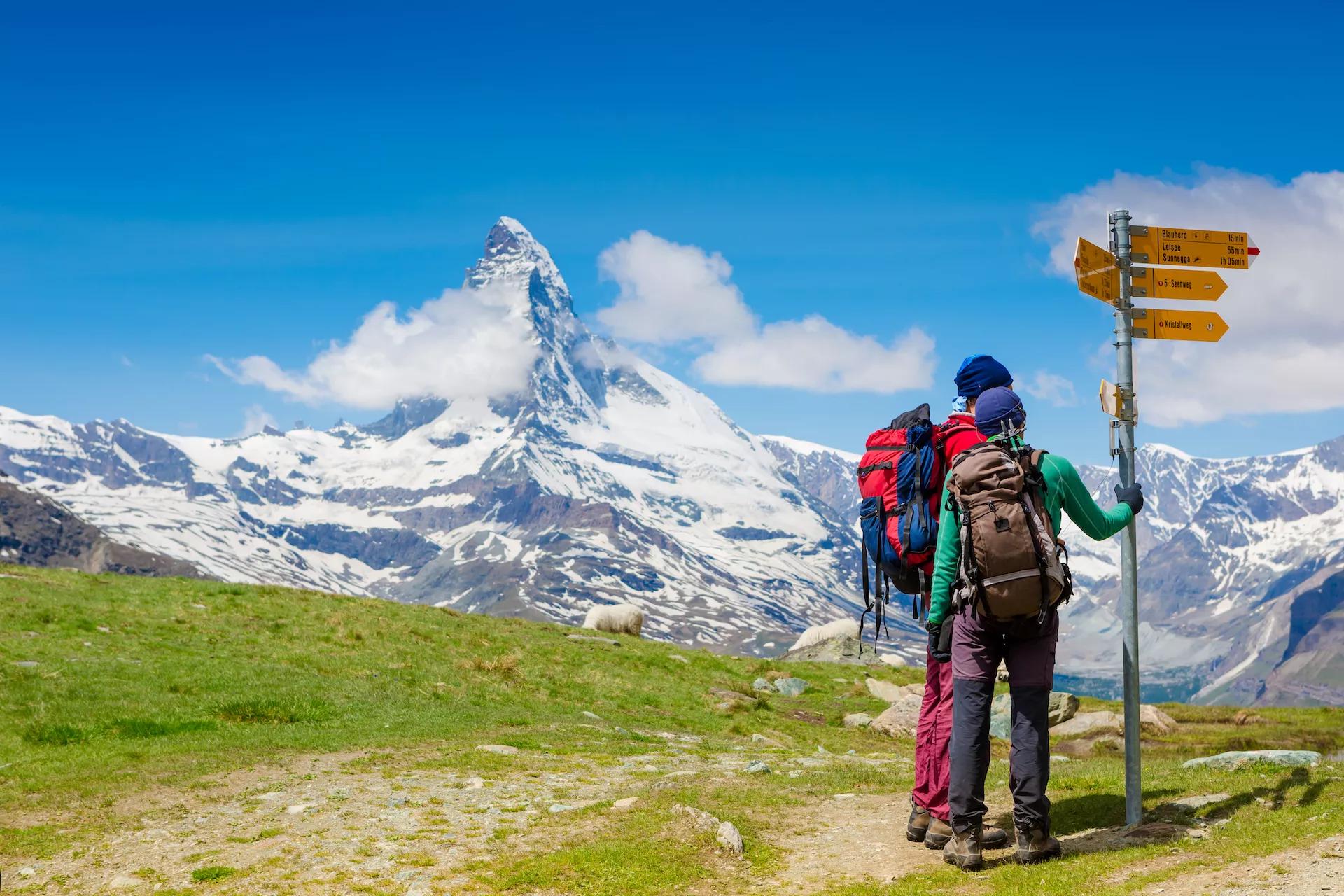
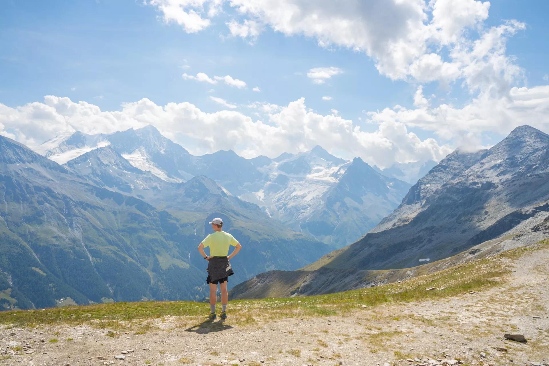
Set out on the Walker’s Haute Route self-guided and hike this iconic trek from Chamonix to Zermatt amongst the highest peaks of the Alps.
Price
From: 2395€/person
Starting point
Chamonix
Finish point
Zermatt
Duration
14 days / 13 nights
Technical level
Fitness level
Inquiry
Admire the views of both Mont Blanc and Matterhorn — the two most iconic peaks in the Alps
Hike the Walker’s Haute Route self-guided and let us handle the logistics
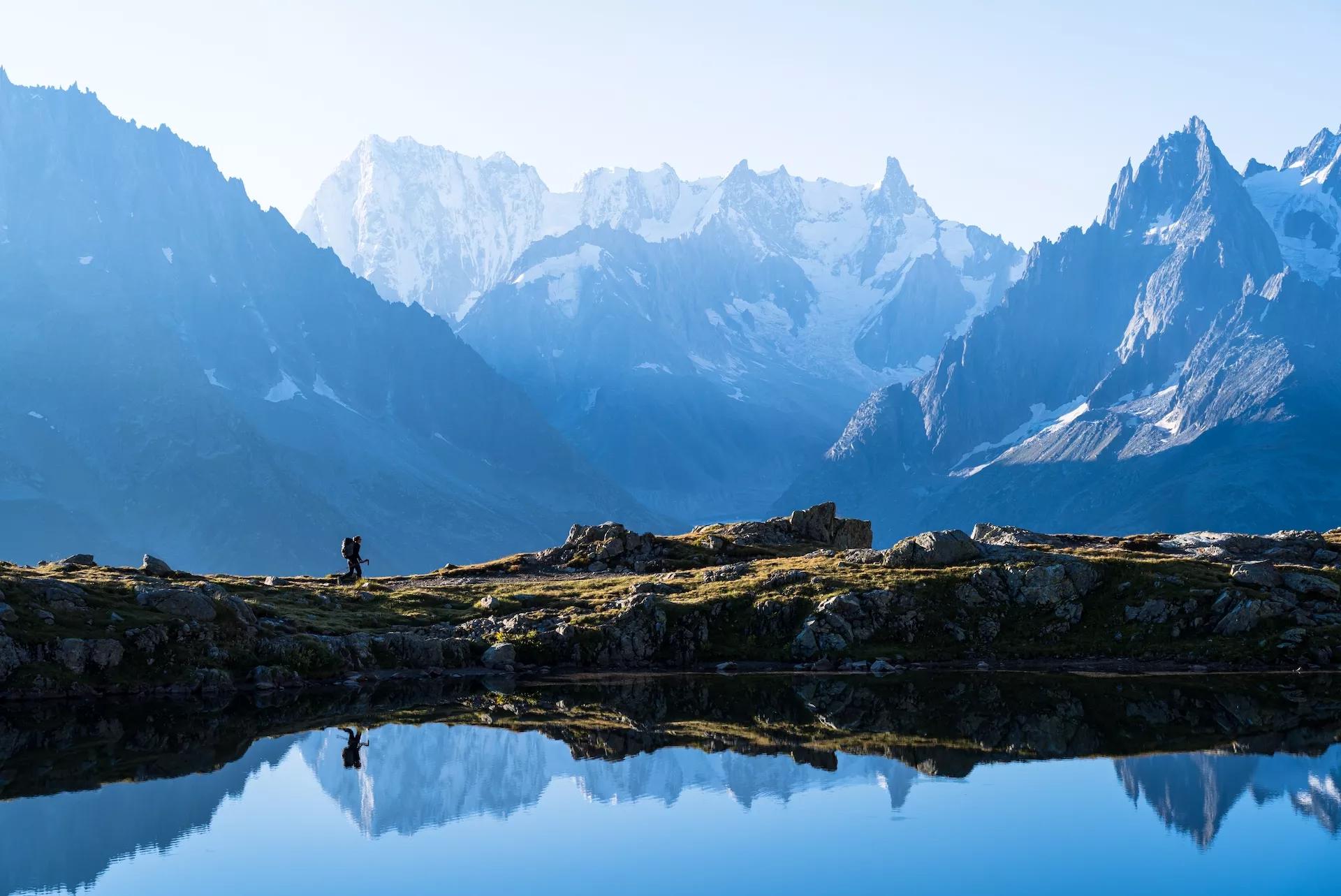
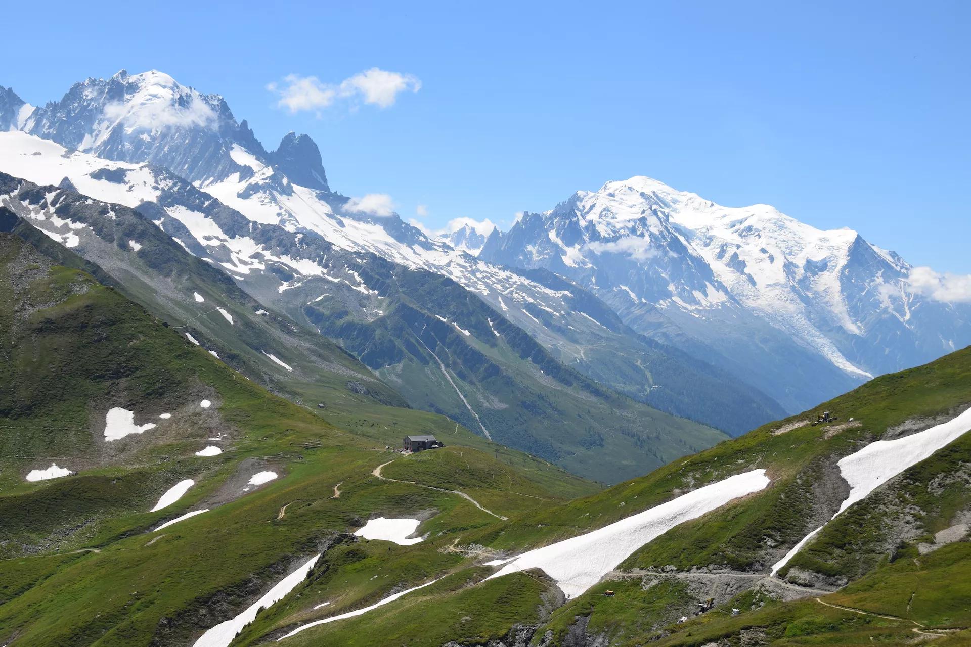
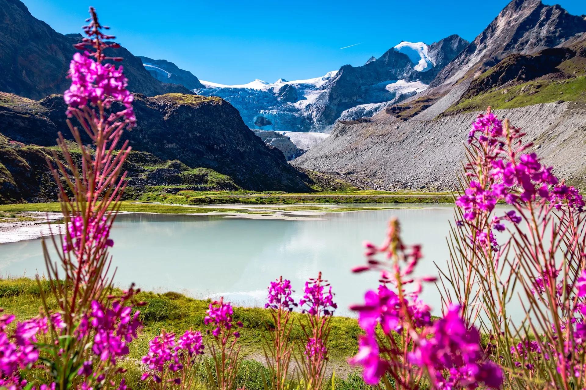
Trek through the most picturesque landscapes of Switzerland and France
Complete the full route on this 14-day itinerary
Sleep in mountain huts with incredible views
The first stages of the Haute route share the trail with Tour du Mont Blanc
Pennine Alps near Zinal in the swiss canton Valais
Majestic Weisshorn seen from Col de Sorebois
The Walliser alps peaks over the Mattertal valley
Zermatt town and Matterhorn mountain
City of Martigny and Sembrancher in the Southern Switzerland
Sunset panorama of the Lac Blanc lake with Mont Blanc
Exciting morning view of Stellisee lake with Matterhorn peak on background
Beautiful day on the rocky road accross meadows in the Swiss Alps leading to the Fenetre d´Arpette pass
A hiking trail leading towards Mont Collon near Arolla
The Alphubel over the Mattertal valley
Lac Bleu above Arolla
Cows will be your loyal companions

Itinerary

Day 1: Chamonix – Argentiere

The first day starts strong. Your goal is just a little higher up in the Chamonix Valley, but to get there, take the trail to the iconic Lac Blanc. After taking in postcard views of the Mont Blanc massif, descend the TMB ladders, where the day ends in Argentiere.

If you’d like to start the Haute Route easier or you want to get in some hiking on the day of arrival, you can also take the direct way to Argentiere, following the gently ascending trail along the valley.

Hiking

17km and 1350m elevation gain

Pictures of Valley of Chamonix closer the village of Argentiere
Lac des Cheserys with a view at the beautufil mountains of Chamonix
Vallon de Berard Nature Preserve Chamonix Graian Alps
Pictures of Valley of Chamonix closer the village of Argentiere
Lac des Cheserys with a view at the beautufil mountains of Chamonix
Vallon de Berard Nature Preserve Chamonix Graian Alps
Day 2: Argentiere – Trient

The last day in France will be relatively undemanding. Following the ridge of Aiguillette des Possettes, it takes you to Col de Balme, the border of Switzerland. When you leave France, you also leave the most up-close views of the Mont Blanc massif behind (though they return later), descending down into the green pastures of the Swiss village Trient.

Hiking

16km and 1200m elevation gain

Col de Balme on the border of France and Switzerland with a view of Mont Blanc in the background
Idyllic Trient river and valley in Valais
The alpine village of Trient in the canton of Valais
Col de Balme on the border of France and Switzerland with a view of Mont Blanc in the background
Idyllic Trient river and valley in Valais
The alpine village of Trient in the canton of Valais
Day 3: Trient – Champex

A challenging path awaits you on the third day. You’ll ascend over the Fenetre d’Arpette, with spectacular views of the Glacier du Trient. The tricky rocky descent soon turns into a pleasant walk into the green valley, where Champex-Lac, the welcoming town beside a lake, awaits.

In the case of bad weather, the easier Bovine route (part of the Tour du Mont Blanc) is preferable.

Hiking

15km and 1350m elevation gain

Beautiful day on the rocky road accross meadows in the Swiss Alps leading to the Fenetre d´Arpette pass
Steep mountain trail hiking up the summit in spring Fenetre d'Arpette
Fenetre d'Arpette pass
Beautiful day on the rocky road accross meadows in the Swiss Alps leading to the Fenetre d´Arpette pass
Steep mountain trail hiking up the summit in spring Fenetre d'Arpette
Fenetre d'Arpette pass
Day 4: Champex – Le Châble

As the only day on the trail without huge mountains, you’ll explore more of the Swiss countryside. You will follow the side of the picturesque Val Ferret and into Sembrancher of Val de Bagnes, where you hike along the river towards Le Châble. Even without any big mountains in sight, this day is still interesting as it shows you ordinary Switzerland, not often advertised.

Hiking

14km and 300m elevation gain

Champex a charming village surrounded by mountains and a lake
The town Le Chable in Swiss Alps seen from above on a clear bright summer morning
City of Martigny and Sembrancher in the Southern Switzerland
Champex a charming village surrounded by mountains and a lake
The town Le Chable in Swiss Alps seen from above on a clear bright summer morning
City of Martigny and Sembrancher in the Southern Switzerland
Day 5: Le Châble – Cabane du Mont Fort

Start early and get ready for a big climb on this day. The steep footpaths will take you above the tree line, on the slopes of the world-renowned Verbier ski resort. Traversing them, you will soon start to notice another great Alpine massif — the Grand Combin — before reaching the Cabane du Mont Fort hut, where you end the day.

Hiking

12km and 1650m elevation gain

The town Le Chable in Swiss Alps seen from above on a clear bright summer morning
Croix of Coeur of Verbier
The town Le Chable in Swiss Alps seen from above on a clear bright summer morning
Croix of Coeur of Verbier
Day 6: Cabane du Mont Fort – Cabane de Prafleuri

The sixth day presents itself a stage full of contrasts — first the panoramic green ridges with a good chance of seeing an ibex, and then the moonlike plateau. From the panoramic trail over Col Termin (optional over Col de Louvie), you’ll soon reach the dying Grand Désert Glacier. The route takes you just below it, on the barren land of scree and stones. After passing many small lakes, you cross over Col de Prafleuri (2987 m), the highest point on the Haute Route. From there, you’ll soon reach the hut of Cabane de Prafleuri.

Hiking

17km and 1000m elevation gain

Trail to Col Termin
Trail to Col Termin
The views from the way to Col Termin
Trail to Col de Prafleuri and Cabane de Prafleuri
Trail to Col Termin
The views from the way to Col Termin
Trail to Col de Prafleuri and Cabane de Prafleuri
Day 7: Cabane de Prafleuri – Arolla

This stage will keep you high up in the mountains, with some of the best views on the Haute Route. Lac de Dix will surprise you just over the morning Col. After traversing alongside this 5 km long accumulation lake, you’ll cross over the morain of Glacier de Cheilon, admiring the pyramid-shaped Mont Blanc de Cheilon on your right. You have two passes you can choose before descending down to Arolla. One has ladders and the other will give you a slight glimpse of Matterhorn.

Hiking

18km and 750m elevation gain

View from Cabane de Prafleuri
View of the Rosablanche glacier from Col de Prafleuri
View of the Lac des Dix
View from Cabane de Prafleuri
View of the Rosablanche glacier from Col de Prafleuri
View of the Lac des Dix
Day 8: Arolla – La Sage

This stage is easier, and doesn’t feature any high mountains, but still very scenic. It takes you down the valley from Arolla, past typical Swiss villages, towards Les Hauderes. In between, you can also do a detour to the small but fairytale-like Lac Bleu. The day ends at the small village of La Sage.

Hiking

11km and 250m elevation gain

A hiking trail leading towards Mont Collon near Arolla
Lac Bleu above Arolla
View of a small village Les Hauderes
A hiking trail leading towards Mont Collon near Arolla
Lac Bleu above Arolla
View of a small village Les Hauderes
Day 9: La Sage – Cabane de Moiry

You’ll climb your way up from the valley towards the ridge above Val d’Hérens, crossing it at its lowest point in Col du Tsate. After a descent to the small Lac Châteaupré, the way up along the Moiry Glacier begins. As the landscape becomes rockier and you start to get a closer look at the glacier, switchbacks will bring you to one of the best-situated huts on the route. The Cabane du Moiry has a great atmosphere and is for many people a destination on its own.

Hiking

11km and 1650m elevation gain

Mountain peaks and chalets in Val d'Herens
View of the Moiry Glacier from the Lac de Chateaupre surrounded by flowers in summer
Cabane de Moiry
Cabane de Moiry
Mountain peaks and chalets in Val d'Herens
View of the Moiry Glacier from the Lac de Chateaupre surrounded by flowers in summer
Cabane de Moiry
Day 10: Cabane de Moiry – Zinal

After a breakfast admiring the view through the panoramic glass windows of the hut’s dining room, head back down yesterday’s path to Lac de Moiry. The ascent then leads towards Col de Sorebois, a great outlook over Val d’Anniviers and iconic peaks like Weisshorn (4505 m). The descent to Zinal is steep and long, but can be shortened about halfway by a cable car.

Hiking

16km and 550m elevation gain

The Moiry Mountain Refuge in the Val d'Anniviers
Lac de Moiry in Canton of Valais
Majestic Weisshorn seen from Col de Sorebois
The Moiry Mountain Refuge in the Val d'Anniviers
Lac de Moiry in Canton of Valais
Majestic Weisshorn seen from Col de Sorebois
Day 11: Zinal – Gruben

This is the first day when you will cross into the German-speaking part of Switzerland. The ascending trail leads high above the Zinal Valley with great views of its head every time you look behind. The shortest route to the valley of Turtmanntal on the other side is across Forcletta pass. If you have more time, you can also extend the trail with a night stay at the Victorian Hotel Weisshorn, and hiking across Meidpass the next day. The common goal of these options is Gruben, a small village only occupied in the summer.

Hiking

17km and 1200m elevation gain

Pennine Alps near Zinal in the swiss canton Valais
Cows will be your loyal companions
Pennine Alps near Zinal in the swiss canton Valais
Cows will be your loyal companions
Day 12: Gruben – St Niklaus

This is another day full of contrasts, crossing the last mountain pass on the Walker’s Haute Route. From the green forests above Gruden, across the rocky landscape of Augstbordpass, you’ll be walking on a historical trading route. After coming around the corner, the epic views of Mattertal valley will vow you. Although no sight of Matterhorn yet, you’ll see Dom (4545 m), the highest peak only in Swiss territory). Past the lovely hamlet of Jungen, descend into the valley into St. Niklaus.

Hiking

17km and 1000m elevation gain

View from Augstbordpass
Mattertal Valley
Mattertal Valley
Village of Jungen
Village of Jungen
View from Augstbordpass
Mattertal Valley
Village of Jungen
Day 13: St Niklaus – Europahutte

The last two-day stretch on the Walker’s Haute features one of the best hikes in the alp, the Europaweg. Redesigned in 2021, because of a landslide, its first part now takes you from Gasenried to Herbriggen at a lower altitude. Taking the valley route from St. Niklaus to Herbriggen can shorten this long stage. From there, a long but grand ascent to the Europahutte begins. With epic views at every stop, including the panorama with Matterhorn, you’ll cross suspension bridges and soon arrive at the end.

Hiking

17km and 1600m elevation gain

The Walliser alps peaks Bishorn, Weisshorn, Schalihorn, and Rothorn over the Mattertal valley
Europa Hut in Mattertal
The Walliser alps peaks Bishorn, Weisshorn, Schalihorn, and Rothorn over the Mattertal valley
Europa Hut in Mattertal
Day 14: Europahutte – Zermatt

Every grand route should have a grand ending, and this one is exactly that. You’ll be traversing up high above the valley, crossing the longest pedestrian suspension bridge in the world, all with the imposing view of the sharp Matterhorn at the end of the valley. After Sunegga, descend down into Zermatt — the end of the Walker’s Haute Route.

Hiking

22km and 600m elevation gain

The panorama of swiss walliser alps with the Matterhorn and Breithorn peaks
Europaweg trail leads the eye trough lush green meadows to the distant Matterhorn
Zermatt town and Matterhorn mountain
The panorama of swiss walliser alps with the Matterhorn and Breithorn peaks
Europaweg trail leads the eye trough lush green meadows to the distant Matterhorn
Zermatt town and Matterhorn mountain

Included in price

14x Accommodations with breakfast
Dinner in the huts and auberges
Tour design and organization
Booklet with detailed itinerary and route instructions
Service and support during your hike
GPS navigation with an easy-to-use app

Optional Extras

Transfer to Chamonix
Transfer from Zermatt

The Walker’s Haute Route is probably one of the most epic hikes in the Alps.

From Chamonix to Zermatt, from Mont Blanc to Matterhorn — it connects the two most important mountaineering centers in Europe and two of its most iconic mountains. You can confidently say that you’ve been to this part of the world after you experience all the diverse scenery on this long-distance route.

The Walker’s Haute Route is a challenging trek, tougher than some of its counterparts (like Tour du Mont Blanc). This makes it more rewarding, with fewer crowds on its trails. It starts in France, overlapping with the TMB, and soon enters Switzerland, where it stays until the end.

It has 14 stages that a reasonably fit hiker can complete in 14 days of about 5-7 hours of hiking, with optional detours that can extend it for an extra day (Hotel Weisshorn). Crossing many mountain passes that never quite reach 3000 m of elevation, the Haute Route trek is challenging without even considering the planning aspect.

We can help this once-in-a-lifetime adventure be as hassle-free as possible.

We take your wishes and preferences to best advise you on your perfect Walker’s Haute Route itinerary. We book all of your accommodations and other services, so you can focus on the journey. And a few weeks before setting off, we’ll send you the detailed itinerary booklet with the planned GPS route.

All that’s left for you is to get to Chamonix and start walking!

But if you are short on time, you can also choose to hike just half of the Walker’s Haute Route — the West or the East.

Map

Start planning today!

The sooner the better - guaranteed availability and best prices if you don't wait for too long.
Inquire now

Things to know

The summer season for hiking is usually from mid-June to mid-October. Its start depends on the amount of snow left on the high mountain passes from the winter. The Walker’s Haute Route and Via Alpina have some high passes, which are usually free of snow only in July. Hiking before that could be dangerous without proper skill and equipment. In October, there is usually the first bigger snowfall, and the huts close to prepare for the winter ski season.

Read more about the hiking season in the Swiss Alps here.

We’ve rated our tours on a difficulty scale from 1 to 5 — with 1 being the easiest and 5 the most difficult.

The difficulty level of a tour tells you how fit you need to be and how much hiking is involved. Most of our tours are appropriate for people who are regularly active and can hike for about five to seven hours per day.

Technical difficulty means how skilled you need to be to hike on the path. Level 1 means the trail is smooth and wide (like a gravel road), while 5 means the surface is uneven and exposed, and you have to use your hands to help yourself move forward. In practice, that means that the higher the level, the more surefooted and skilled in scrambling you need to be.

It is best to book your tour early because most accommodations along the trail fill up quickly. That way, you can ensure that you have a place to stay.

Even though the routes are usually quite close to at least a farm or a small village, they also feature lots of wild and remote sections where you cannot just stop. In case of injury, it’s best to call the local emergency services.

On the other hand, if you just feel that you cannot hike anymore, you can always stop in any of the towns and villages along the way and use public transport to get to a bigger Swiss city.

Showers in Swiss mountain huts are rare and are only offered for an extra charge. That’s why it’s wise to bring wet wipes with you for the days that you are staying in one of them.

No, because the huts provide their own blankets and pillows. Still, you should bring a sleeping liner instead.

Cell connection is very changeable in the mountains. A good rule of thumb is that if you can see a town, you’ll have a reception. Mountain huts are the same — the signal usually doesn’t reach the insides, so try catching it outside. Wifi is available only in some huts, while most don’t have it.

If you dress accordingly, most stages can be done in light rain. However, do not hike if a storm is forecasted. In that case, you can take public transport to the next point when possible to make up for the lost time.

Vegetarian meals are usually available in most accommodations. Vegan options are harder to be found in huts, but we’re happy to let you know about them in advance so you can plan accordingly.

Comparing it to other classic treks in the Alps, the Haute route is the most difficult out of all of them. Each day features a lot of distance, ascent, and descent, with the routes often rocky, exposed, and steep. For comparison, the Haute Route’s average mountain pass is as difficult as the most difficult part of the Tour du Mont Blanc.

Still, the Haute Route is a hike first and foremost, and only a few rare sections demand the use of hands.

More about the Walker’s Haute Route difficulty >

Chamonix is the starting point of the Walker’s Haute Route and it is pretty easy to get to from the Geneva international airport by train, bus, or shuttle.

The hike ends in Zermatt, from where there are good train connections to the airports of Zurich and Geneva.

Learn more about the travel options >

Huts mostly offer dormitories only, but some also have a few private rooms for 2 or 4 available. Please note that we require a very early booking for these rooms. We will do our best to get you the best possible accommodation from what is available at the time of your booking.

You can read more about the accommodations on the way here.

You can, but they need to be used of long hiking days and surefooted. We therefore recommend that they’re at least 8 years old.

Most of the stages can be shortened via cable cars or other modes of public transportation, saving your knees on the downhills or catching up on lost time because of bad weather.

Haute Route has many sections which are remote and hardly accessible, which is why we do not offer luggage transfer. The best option is to pack light, so check our packing list.

The Walker’s Haute Route starts in France but leads mostly through Switzerland. Therefore you should have some euros (EUR) with you, but most cash should be in Swiss francs (CHF).

Klemen
Talk to our travel expert
mail
info@huttohuthikingswitzerland.com
phone
+386 31 22 44 88
Book a call
Usually replies within 4 hours!
Inquire now
Book now before it's gone
The accommodations are likely to sell out
Covid refund guarantee
Money-back in case of covid restrictions
Fast and easy booking
Book you activity in few minutes
Guaranteed best prices
No additional costs
Happiness Guaranteed
Or we will return your money
We care about the planet 🌍 Read more >
travel-life-logo tourism-logo green-safe-logo travel-agency-logo

Hassle-Free

We handle itineraries, accommodations, and anything else you prefer not to deal with, so you can enjoy a carefree hike.

Book with confidence

We are a financially protected company, fully bonded and insured, keeping your money safe and allowing you to travel with confidence.

Tried & Tested Adventures

Only the best hut to hut hikes of Switzerland, cherry-picked by our local team with an in-depth knowledge of the region.

Unbeatable support

Our 24/7 customer support is where we show our passion, bringing you a better experience by making your well-being our number one priority.

Similar Switzerland Hiking Tours

Panoramic trail from Mannlichen to Kleine Scheidegg with Mount Eiger view
Spectacular principal street of Lauterbrunnen with and stunning Staubbach waterfall in background
Kleine Scheidegg with Eiger Nordwand background
Amazing tourquise Oeschinnensee with waterfalls and Swiss Alps Kandersteg
Panoramic view of Lauterbrunnen valley village of Lauterbrunnen the Staubbach Fall and the Lauterbrunnen Wall
View to the mountain Eiger
The valley called Kiental
Fabulous autumn view of picturesque alpine Wengen village and Lauterbrunnen Valley
Hiking above Grindewald
Kleine Scheidegg train station
From: 1039€/person
Best Seller
7 days / 6 nights
Discover the highlights of the Swiss Via Alpina by hiking the Bear Trek, our favorite section of the classic long-distance trail in the European Alps.
More →
View of the Moiry Glacier from the Lac de Chateaupre surrounded by flowers in summer
A hiking trail leading towards Mont Collon near Arolla
Valais Blacknose sheep in front of Matterhorn
The Moiry Mountain Refuge in the Val d'Anniviers
Majestic Weisshorn seen from Col de Sorebois
Cows will be your loyal companions
Europaweg trail leads the eye trough lush green meadows to the distant Matterhorn
The Walliser alps peaks Bishorn, Weisshorn, Schalihorn, and Rothorn over the Mattertal valley
Zermatt town and Matterhorn mountain
From: 1560€/person
7 days / 6 nights
Spend a week on the eastern Haute Route, hiking through the Swiss Alps below sharp ridges and epic glaciers all the way to the foot of the iconic Matterhorn.
More →
Lac des Cheserys with a view at the beautufil mountains of Chamonix
Pictures of Valley of Chamonix closer the village of Argentiere
Idyllic Trient river and valley in Valais
The alpine village of Trient in the canton of Valais
Champex a charming village surrounded by mountains and a lake
The town Le Chable in Swiss Alps seen from above on a clear bright summer morning
The views from the way to Col Termin
View from Cabane de Prafleuri
View of the Rosablanche glacier from Col de Prafleuri
From: 1390€/person
7 days / 6 nights
A short version of the iconic Walker’s Haute Route, leading you from the Chamonix valley below Mont Blanc to the mountain passes in the Swiss Alps.
More →
Kleine Scheidegg with Eiger Nordwand background
Shonegg lake with alps in the background
Alpine marmots in grass in Berner Oberland
Wonderful Stauber Waterfall in the Schachen Valley
Hiking above Grindewald
Klausenpass mountain road connecting cantons Uri and Glarus
Houses in the Swiss village of the Engelberg resort
A tourist train travels on Jungfrau Railway from Jungfraujoch to Kleine Scheidegg
Wengen with Jungfrau Mountain and Lauterbrunnen Valley on background
Amazing tourquise Oeschinnensee with waterfalls and Swiss Alps Kandersteg
Montreux city with Swiss Alps lake Geneva and vineyard on Lavaux region
From: 4490€/person
18 days / 17 nights
Plan your Via Alpina self-guided hike across Switzerland and explore the diversity of the Alps on this epic journey, previously known as the Alpine Pass Route.
More →
Self-guided trekking tours in Switzerland, hiking from hut to hut across epic Alpine landscapes and enjoying hearty meals served alongside breathtaking views.
Portfolio company of World Discovery.