Via Alpina Switzerland

Plan your Via Alpina self-guided hike across Switzerland and explore the diversity of the Alps on this epic journey, previously known as the Alpine Pass Route.
Price
From: 4490€/person
Starting point
Sargans
Finish point
Montreux
Duration
18 days / 17 nights
Technical level
Fitness level
Inquiry
Hike the entire Via Alpina Green Trail in Switzerland
Discover the unique landscapes and rich culture of the Swiss Alps
Enjoy extraordinary views while crossing over 14 mountain passes
Sleep in mountain huts, hotels, and lovely inns on your hike across the country
We take care of the logistics so you can enjoy your adventure
Kleine Scheidegg with Eiger Nordwand background
Shonegg lake with alps in the background
Alpine marmots in grass in Berner Oberland
Wonderful Stauber Waterfall in the Schachen Valley
Hiking above Grindewald
Klausenpass mountain road connecting cantons Uri and Glarus
Houses in the Swiss village of the Engelberg resort
A tourist train travels on Jungfrau Railway from Jungfraujoch to Kleine Scheidegg
Wengen with Jungfrau Mountain and Lauterbrunnen Valley on background
Amazing tourquise Oeschinnensee with waterfalls and Swiss Alps Kandersteg
Montreux city with Swiss Alps lake Geneva and vineyard on Lavaux region

Itinerary

Day 1: Sargans - Weisstannen

One of the rare stages without a pass, this is a great warm-up to the Via Alpina. You’ll explore the Swiss countryside and walk through villages, meadows, and woods up the river towards Weisstannen.

Hiking

14 km and 650 m elevation gain, 100 m elevation loss

View of Sargans Castle
The village of Mels near Sargan
The Weisstannen village and on the Weisstannental valley
View of Sargans Castle
The village of Mels near Sargan
The Weisstannen village and on the Weisstannental valley
Day 2: Weisstannen - Elm

Continue up the valley on cattle trails towards the first pass of the adventure. Over green pastures, you’ll reach the Foopass (2,223 m) with a great outlook over the Glarner Alps in the distance. Solid paths take you down to the village of Elm, known for preserving its architectural heritage.

Hiking

23 km and 1250 m elevation gain, 1300 m elevation loss

Panoramic view at the Weisstannen village and on the Weisstannental valley
Foopass panorama
Foopass panorama
Elm
Elm
Panoramic view at the Weisstannen village and on the Weisstannental valley
Foopass panorama
Elm
Day 3: Elm - Linthal

One of the most challenging days on the route, it also hikes in some of its most impressive terrain, namely the Swiss Tectonic Arena Sardona. You’ll climb up steep paths along the mountains and green and rocky terrain to Richetlipass (2,261 m). Descend is more leisurely, on a mule path through pastures and later woods towards Linthal.

You can take a gondola lift at the beginning of the stage to lower the elevation gain for the day.

Hiking

24 km and 1450 m elevation gain, 1800 m elevation loss

Elm village and the Swiss mountains
Richetlipass in the Glarnerland
The village of Linthal is located in the upper Linth valley
Elm village and the Swiss mountains
Richetlipass in the Glarnerland
The village of Linthal is located in the upper Linth valley
Day 4: Linthal – Klausenpass

After a short steep part towards Braunwald, you’ll circle the mountainside towards the largest alp in Switzerland (around 1,200 cows). You can optionally end the day there, at the village of Urnerboden, or continue up along the hairpin bend road towards Klausenpass, where you stay the night.

Hiking

17 km and 1300 m elevation gain, 100 m elevation loss

Urnerboden pastures
Urnerboden pastures
The Urnerboden the largest alp in Switzerland is inhabited all year round
Klausenpass mountain road connecting cantons Uri and Glarus
Urnerboden pastures
The Urnerboden the largest alp in Switzerland is inhabited all year round
Klausenpass mountain road connecting cantons Uri and Glarus
Day 5: Klausenpass – Altdorf

The postbus takes you back to the top of the pass, from where you descend on the panoramic trail to the meadows in Aesch. After admiring the wonderful waterfall, continue down the valley along the river to the lake town of Altdorf.

Hiking

22 km and 1100 m elevation gain, 1500 m elevation loss

Klausen pass road near Altdorf
Staubifall in the Uri canton This waterfall is one of the most powerful in the Alps
Beautiful view of idyllic mountain scenery in the Alps with traditional chalets nearby Altdorf city
Klausen pass road near Altdorf
Staubifall in the Uri canton This waterfall is one of the most powerful in the Alps
Beautiful view of idyllic mountain scenery in the Alps with traditional chalets nearby Altdorf city
Day 6: Altdorf – Engelberg

The sixth day is a long one, with over 1800 meters of elevation gain. Only in the beginning do you have a chance to shorten it by taking a cable car to Brüsti, saving you a kilometer of uphill hiking. Ascend the narrow ridge to reach the rocky Surenenpass (2,291 m). From there, a pleasant but long route leads down the green valley into Engelberg, a small town.

Hiking

30 km and 1900 m elevation gain, 1300 m elevation loss

View from the alpine trail leading to Surenenpass from Altdorf to Engelberg
Mountains at the Surenenpass above Altdorf
Engelberg village
Engelberg village
View from the alpine trail leading to Surenenpass from Altdorf to Engelberg
Mountains at the Surenenpass above Altdorf
Engelberg village
Day 7: Engelberg – Engstlenalp

This day starts with a steep ascent, but already halfway, your effort will be rewarded once you reach Engstlenalpsee lake. From there onwards, you’ll have a great view over the Bernese Alps, all the way to Jochpass (2,207 m). After a short downhill, you’ll reach Hotel Engstlenalp, located in surreal alpine surroundings.

Hiking

11 km and 1250 m elevation gain, 450 m elevation loss

Engstlenalpsee in Bernese Alps
The path up to Jochpass
Alpine huts on Engstlenalp in the Bernese Highlands
Engstlenalpsee in Bernese Alps
The path up to Jochpass
Alpine huts on Engstlenalp in the Bernese Highlands
Day 8: Engstlenalp – Meiringen

After passing a few traditional dairy farms at Tannalp, you’ll visit the tranquil lakes on the plateau. From there, the route continues up a narrow ridge to the Plantappen mountain, where you’ll have constant great views over the Jungfrau massif, with Eiger in sight. The descent from the peak to Meiringien is long, so there is an option of hopping on a cable car and saving your knees.

Hiking

20 km and 650 m elevation gain, 1900 m elevation loss

Traditional alpine livestock settlement Tannalp
View from Balmeregghorn towards Steingletscher
Majestic Wetterhorn peak covered by glacier as seen from Planplatten
Traditional alpine livestock settlement Tannalp
View from Balmeregghorn towards Steingletscher
Majestic Wetterhorn peak covered by glacier as seen from Planplatten
Day 9: Meiringen – Grindelwald

An easier day compared to others before it, it takes you over the Grosse Scheidegg. You will also hike past the Reichenbach Falls, made famous by Sherlock Holmes. The route from the pass gently descends through the woods and pastures towards Grindelwald, a popular town amongst tourists.

Hiking

22 km and 1400 m elevation gain, 1000 m elevation loss

Rychenbach river in Meiringen
View of pass way from the first top station to Grosse Scheidegg above Grindelwald
The Reichenbach Falls in Switzerland is a favourite place of the Sherlock Holme fan
Rychenbach river in Meiringen
View of pass way from the first top station to Grosse Scheidegg above Grindelwald
The Reichenbach Falls in Switzerland is a favourite place of the Sherlock Holme fan
Day 10: Grindelwald – Wengen

On day ten, you will hike below one of the most famous rock walls in the Alps, the Eiger North Face. The route will take up from the tourist hustle and bustle into the pastures below this awe-inspiring mountain. On your highest point at Kleine Scheidegg, you can also join the Jungfraujoch railway for an excursion or continue the sunny descent down to Wengen, another famous resort in the region.

Hiking

19 km and 1200 m elevation gain, 900 m elevation loss

The view of Eiger north face from the meadows above Grindewald
Stunning alpine panorama with Jungfrau Monch Eiger North face and Mannlichen cable car station Grindelwald
Kleine Scheidegg train station
The view of Eiger north face from the meadows above Grindewald
Stunning alpine panorama with Jungfrau Monch Eiger North face and Mannlichen cable car station Grindelwald
Kleine Scheidegg train station
Day 11: Wengen – Murren

An easy day takes you in the shade of the woods up onto the sunny terrace on which the car-free town of Murren lies. If you want, you can make this a rest day and just take the cable car.

Hiking

9 km and 850 m elevation gain, 500 m elevation loss

Wengen is your perfect postcard town
Wengen with Jungfrau Mountain and Lauterbrunnen Valley on background
Aerial view over the village of Murren
Wengen is your perfect postcard town
Wengen with Jungfrau Mountain and Lauterbrunnen Valley on background
Aerial view over the village of Murren
Day 12: Murren – Griesalp

Today you will tackle the second-highest pass on the Via Alpina, a good warm-up for the next day (with the highest pass). Climb up the lush meadows past Rotstockhütte, where you can rest before continuing to the Sefinenfurgge Pass (2,612 m). The path down will be unusually dark and rocky for Switzerland but will soon turn back into a lush landscape. Past waterfalls and pastures, you’ll reach the village of Griesalp.

Hiking

17 km and 1100 m elevation gain, 1300 m elevation loss

Enjoying the view in beautiful mountains above Murren
Stairs up Sefinenfurgge Pass
Spectacular views in Kiental from Griesalp to Obere Bundalp
Enjoying the view in beautiful mountains above Murren
Stairs up Sefinenfurgge Pass
Spectacular views in Kiental from Griesalp to Obere Bundalp
Day 13: Griesalp – Kandersteg

Get ready for this extraordinary stage. You’ll hike over Bundalp to the top of Hohtürli Pass (2,778 m), the highest on the whole Via Alpina trail. But just above the pass lies the Blüemlisalphütte, arguably the highlight of the day. Enjoy the rest at this hut at the foot of the glacier before descending to Lake Oeschinen, where you can take the cable railway to Kandersteg.

Hiking

16 km and 1400 m elevation gain, 1650 m elevation loss

The Hohturli pass
The Hohturli pass
Sunset at Bluemlisalphutte
Amazing tourquise Oeschinnensee with waterfalls and Swiss Alps Kandersteg
The Hohturli pass
Sunset at Bluemlisalphutte
Amazing tourquise Oeschinnensee with waterfalls and Swiss Alps Kandersteg
Day 14: Kandersteg – Adelboden

Today’s hike will take you to Bunderchrinde Pass (2,385 m), a rocky window onto the other side of the mountains. You will hike up the river and towards the end of the valley, ascend the meadows to the Lohner Hut, and continue your way to the pass. When there, you’ll have a nice view of the path up ahead, which will zig-zag down into Adelboden.

Hiking

17 km and 1350 m elevation gain, 1200 m elevation loss

Village Kandersteg and the mountain Dundenhorn
Adelboden panorama with alpine farmhouses and trees forests and green meadows
Adelboden village Bernese Oberland
Village Kandersteg and the mountain Dundenhorn
Adelboden panorama with alpine farmhouses and trees forests and green meadows
Adelboden village Bernese Oberland
Day 15: Adelboden – Lenk

This is an easier day, whichever option you choose. You can follow the streams and go past holiday lodges into the grassy pastures above Adelboden on a direct route, or choose to climb up to the ridge to have a better view of the surrounding region. Both routes cross the grassy Hahnenmoospass, where you can have a rest. Descend directly to Lent or take a detour past the Simme waterfalls.

Hiking

20 km and 950 m elevation gain, 1200 m elevation loss

Sillerenbuhl Ski Station from Hahnenmoospass
Alpine village of Lenk
Lenk is a postcard view
Sillerenbuhl Ski Station from Hahnenmoospass
Alpine village of Lenk
Lenk is a postcard view
Day 16: Lenk – Gstaad

The hike will begin with the ascent through the Wallbach Gorge, later giving way to green meadows with all-around views. Crossing this wild landscape, you’ll meet an occasional flock of sheep. You will cross the Trüttlisbergpass and gradually descend into Lauenen, from where you will hike into Gstaad.

Hiking

23 km and 1150 m elevation gain, 1150 m elevation loss

The farms of Gstadd
The farms of Gstadd
The farms of Gstadd
Day 17: Gstaad – Château-d’Oex

This day will take you over another pass, past the Gummfluh peak, the iconic landmark of the area. Once you reach Col du Jable, you’ll also cross over into another linguistic area of Switzerland. Descend to L’Etivaz, taste some of their famous cheese, and continue to Château-d’Oex.

Hiking

26 km and 1500 m elevation gain, 1600 m elevation loss

Chateau d'Oex
Chateau d'Oex
The summer view of mountains from Chateau dOex Fribourg
Chateau d'Oex
The summer view of mountains from Chateau dOex Fribourg
Day 18: Château-d’Oex – Montreux

This last stage is the cherry on top of the cake, especially the on the last descent. You’ll start the final day hiking up above the Lac de l’Hongrin, admiring its dam. After that, the last pass of Via Alpina Switzerland awaits you — Col de Chaude — and a ridge to Rochers de Naye. The views from there are outstanding — you’ll see Lake Geneva and both Jungfrau and Mont Blanc massifs.

The last descent to the Mediterranean micro-climate of Montreux is well worth it, but if you feel it’s too much, you have multiple opportunities along the way to take the train down.

Some people choose to divide this last stage into two days, taking the railway from Rochers de Naye down to Montreux and returning the next day to hike the last descent.

Hiking

Min: 21 km and 1860 m elevation gain, 850 m elevation loss

Max: 33 km and 1900 m elevation gain, 2600 m elevation loss


A beautiful view of Lac de l'Hongrin surrounded by mountains
Panorama view of Bernese Alps from top of Rochers de Naye
Scenic summer panorama from Rochers de Naye mountain peak
A beautiful view of Lac de l'Hongrin surrounded by mountains
Panorama view of Bernese Alps from top of Rochers de Naye
Scenic summer panorama from Rochers de Naye mountain peak

Included in price

19x Accommodations with breakfast
Dinner in the huts and auberges
Tour design and organization
Booklet with detailed itinerary and route instructions
Service and support during your hike
GPS navigation with an easy-to-use app

Optional Extras

Transfers to Sargans
Transfers from Montreux
Luggage transfer
Single supplement

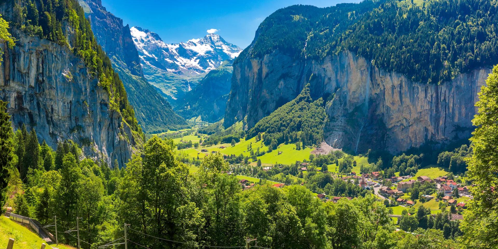
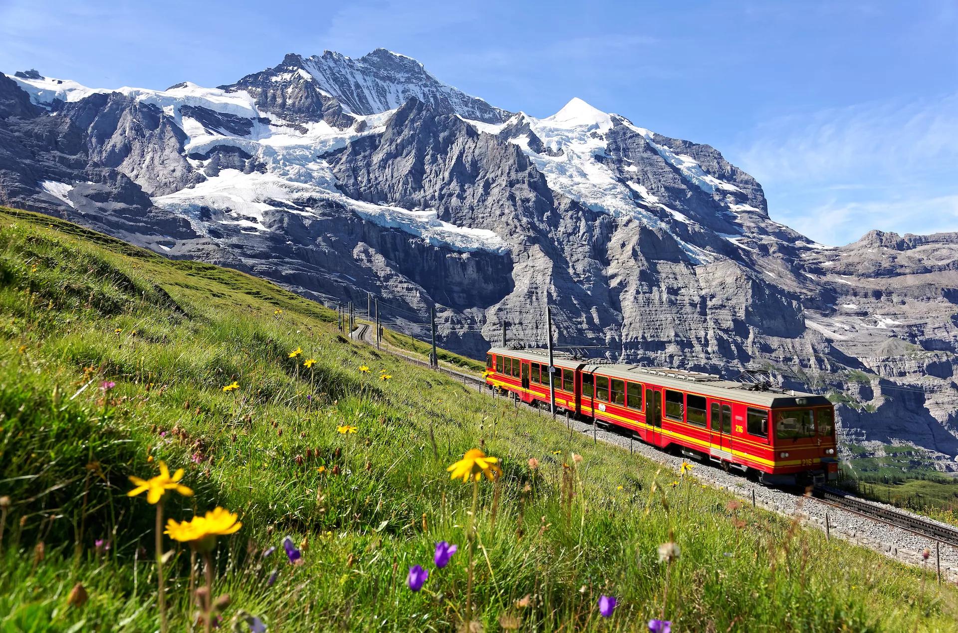
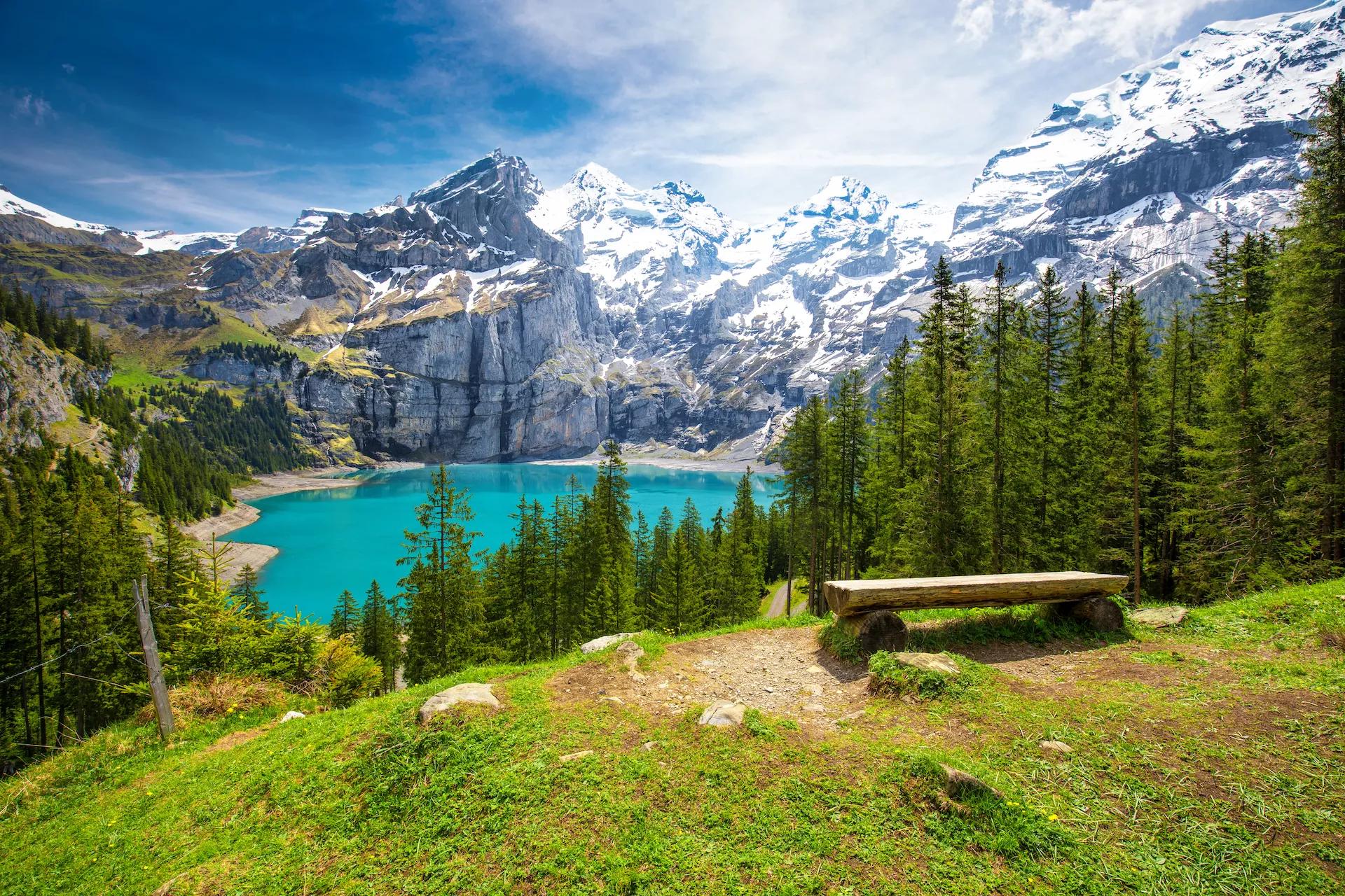
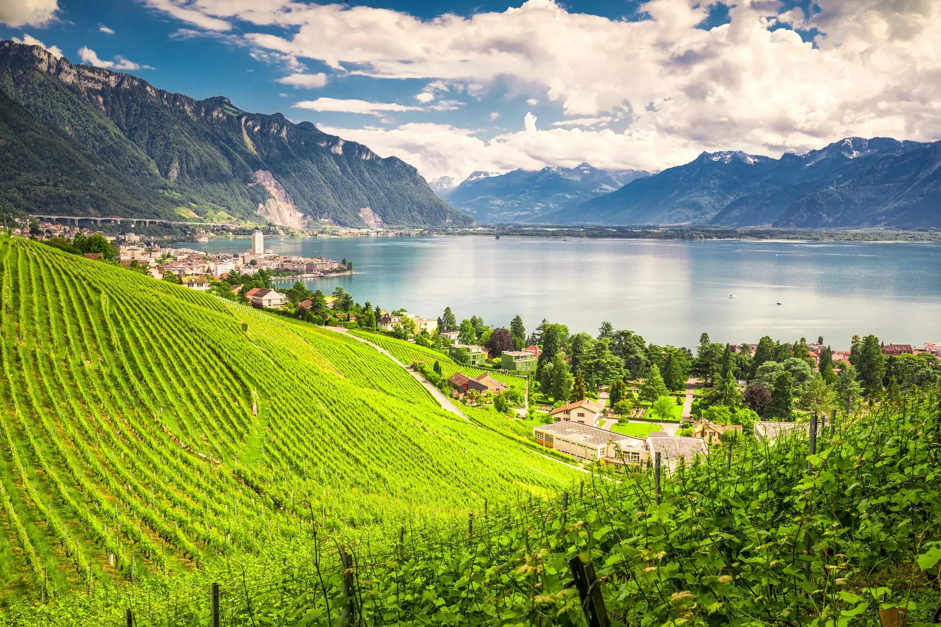
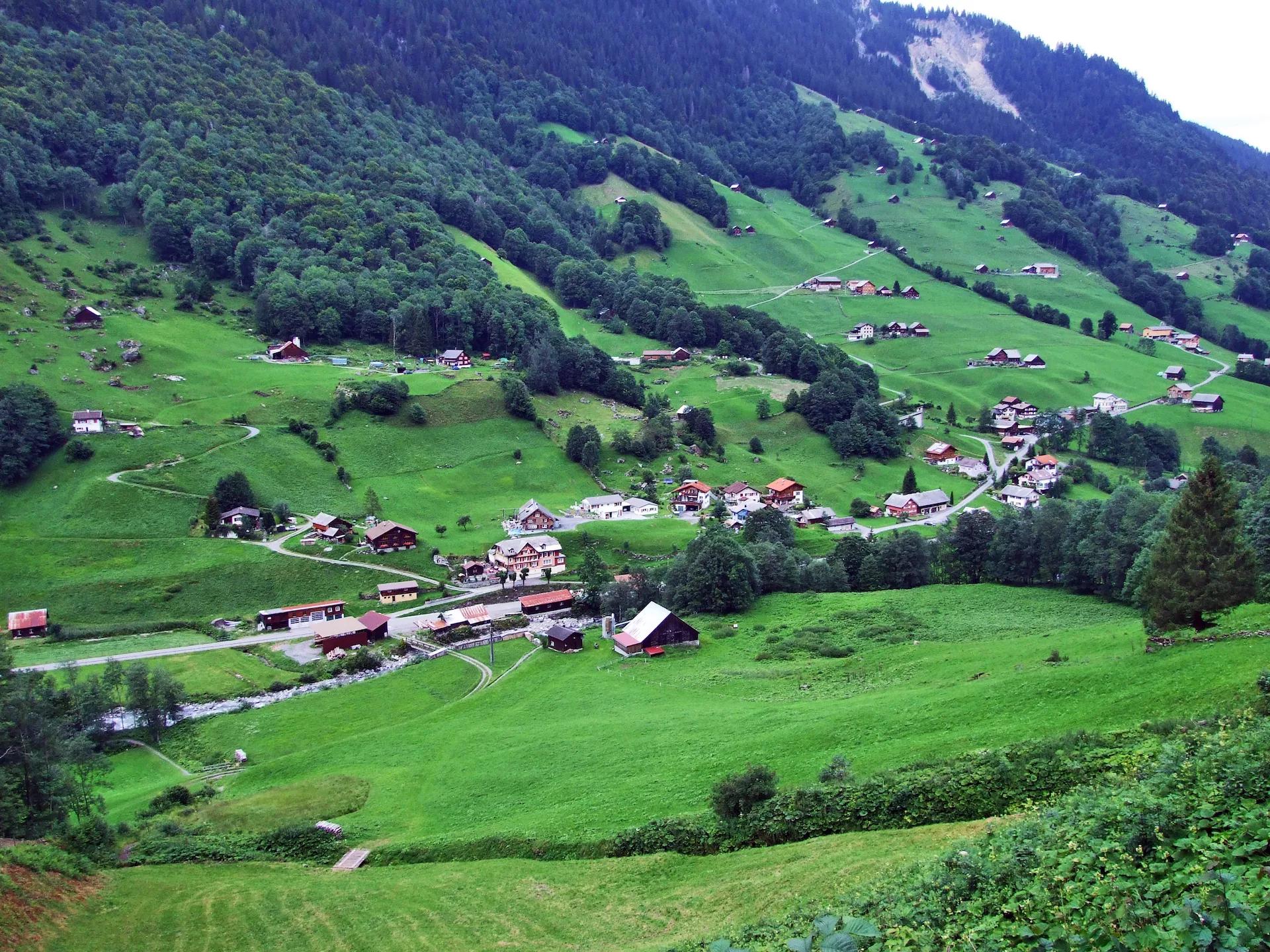
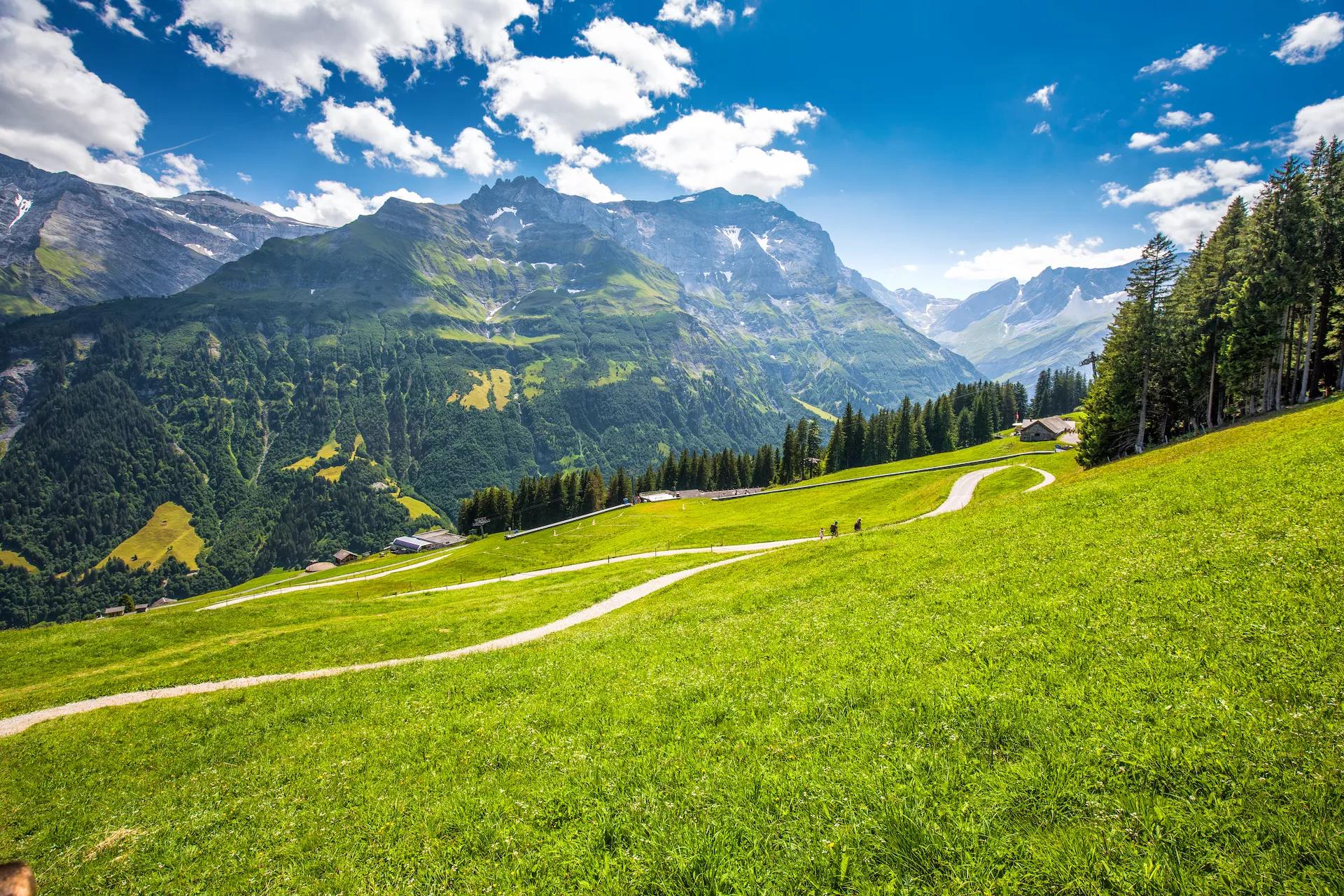
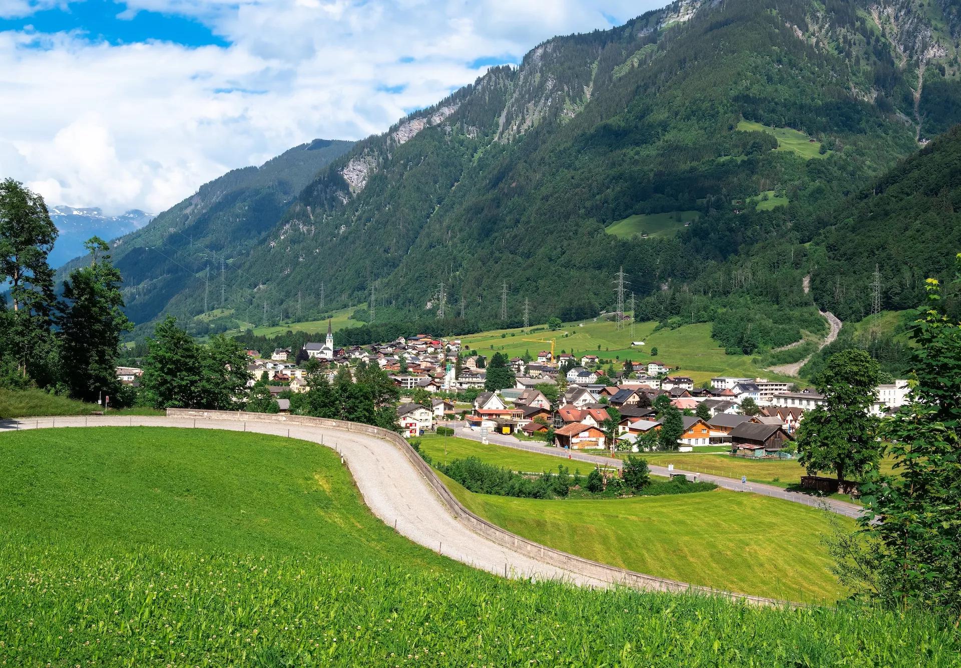
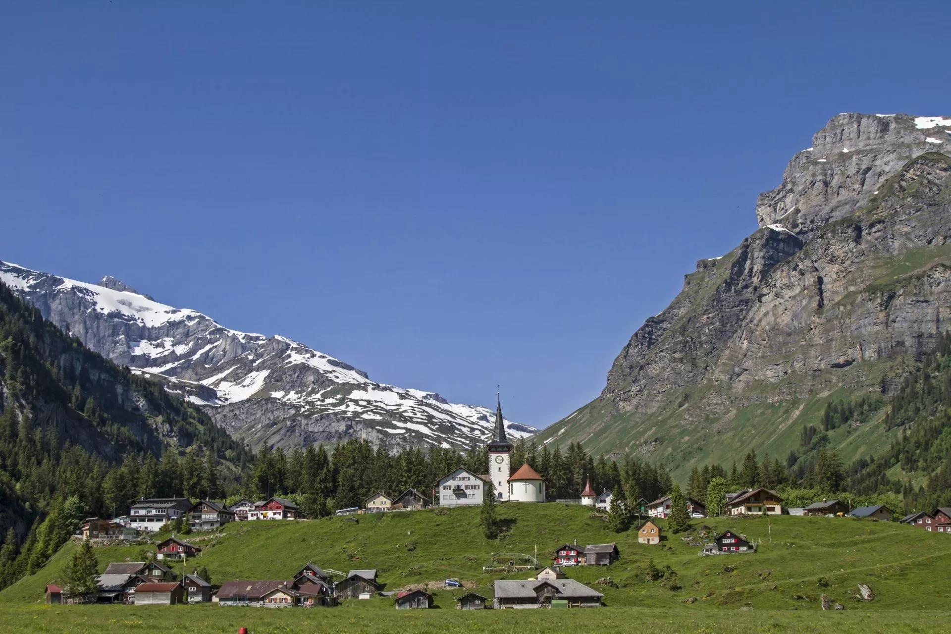
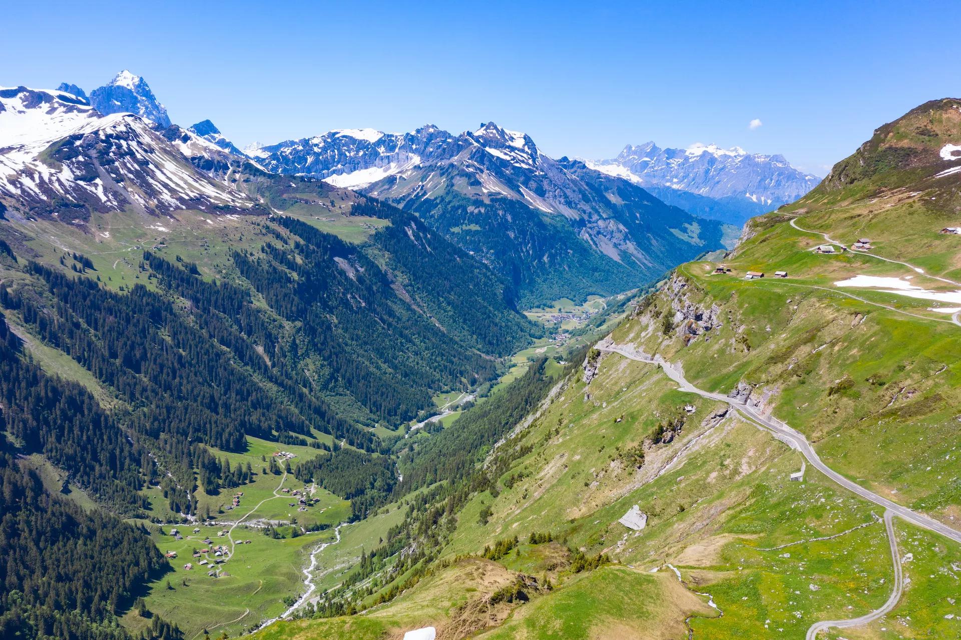
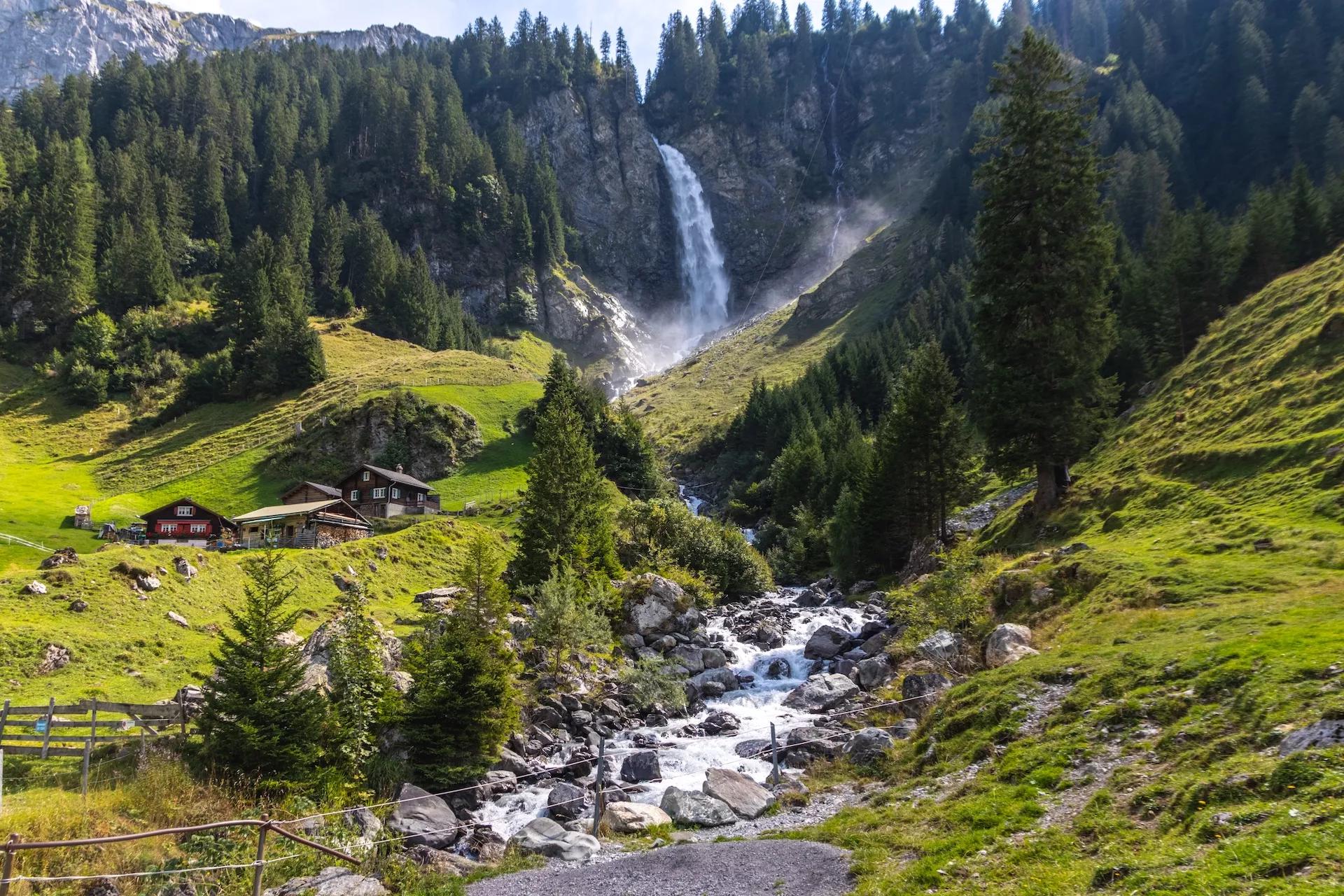
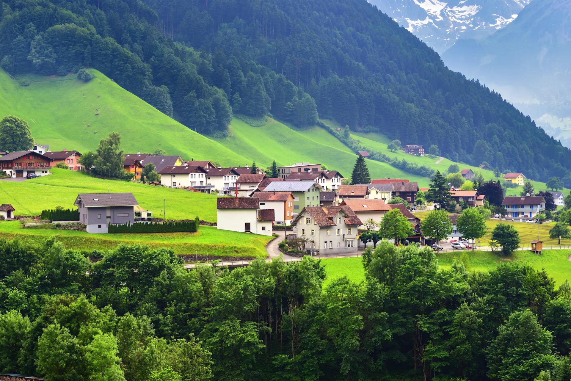
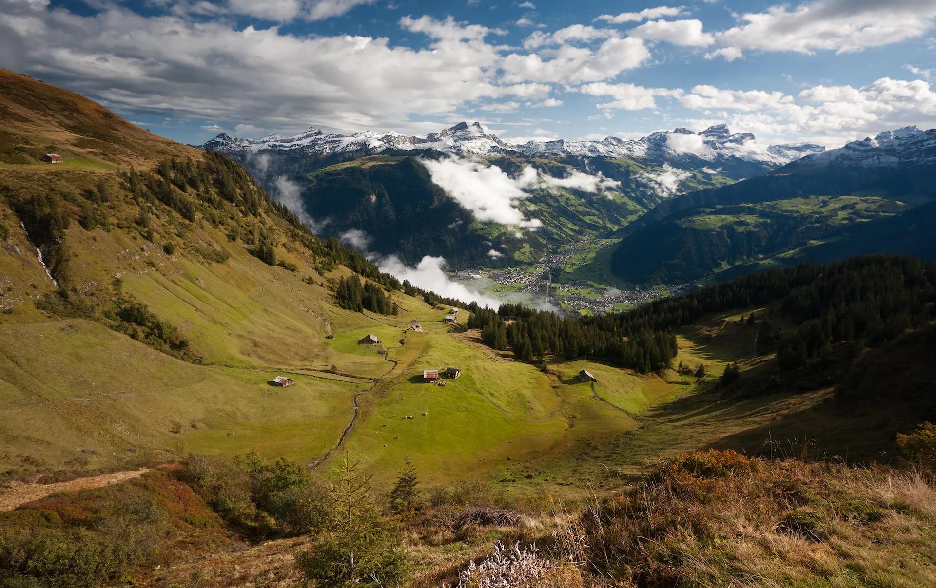
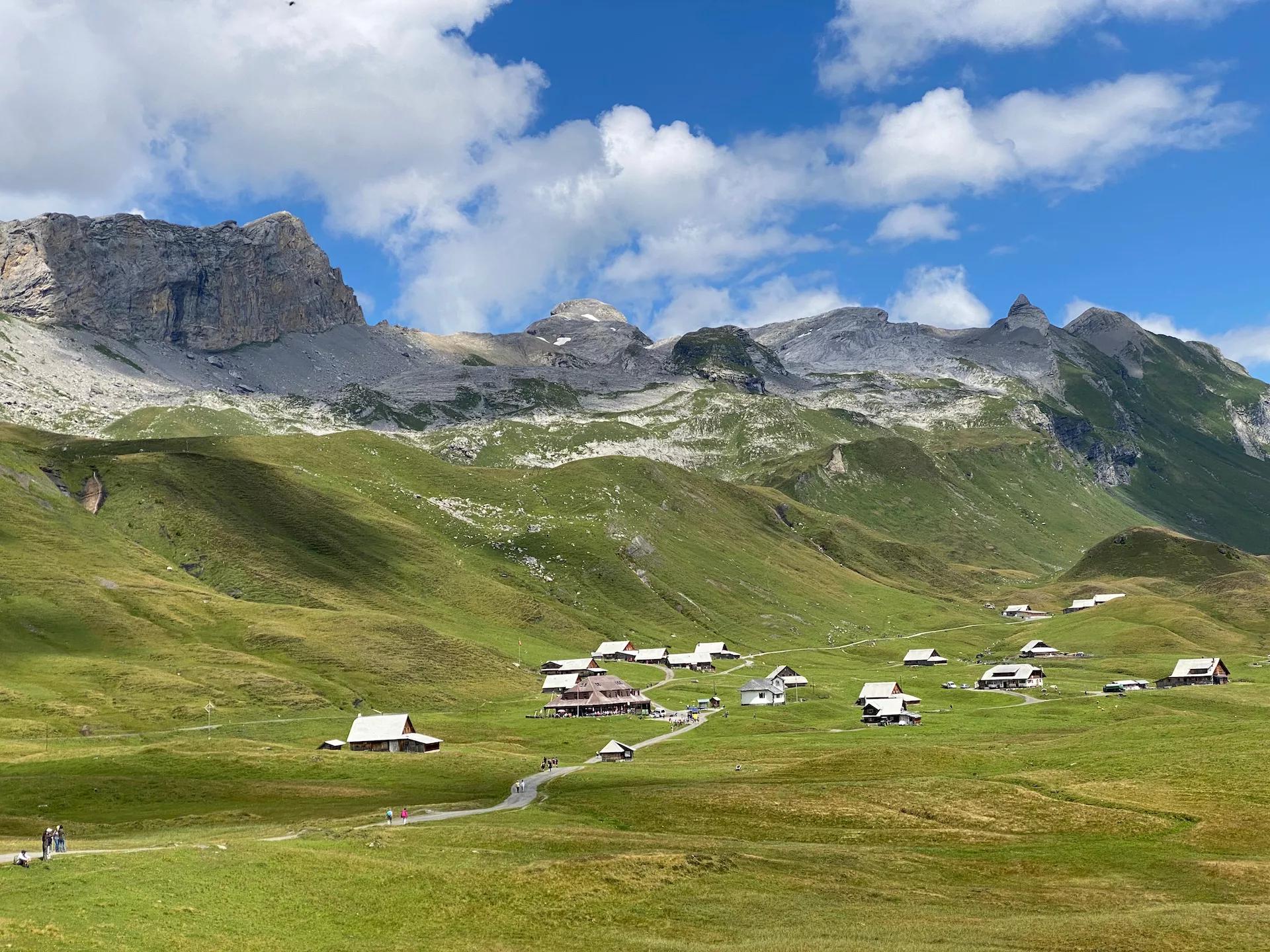
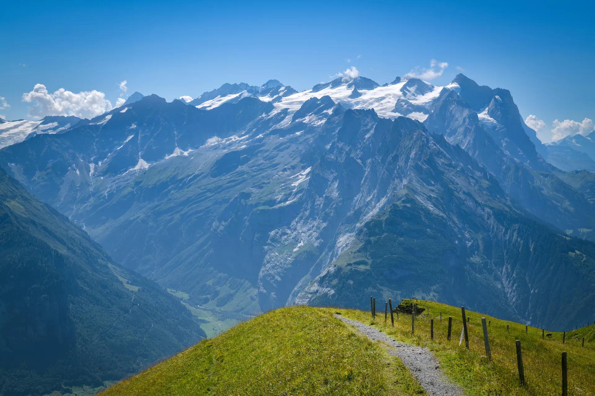
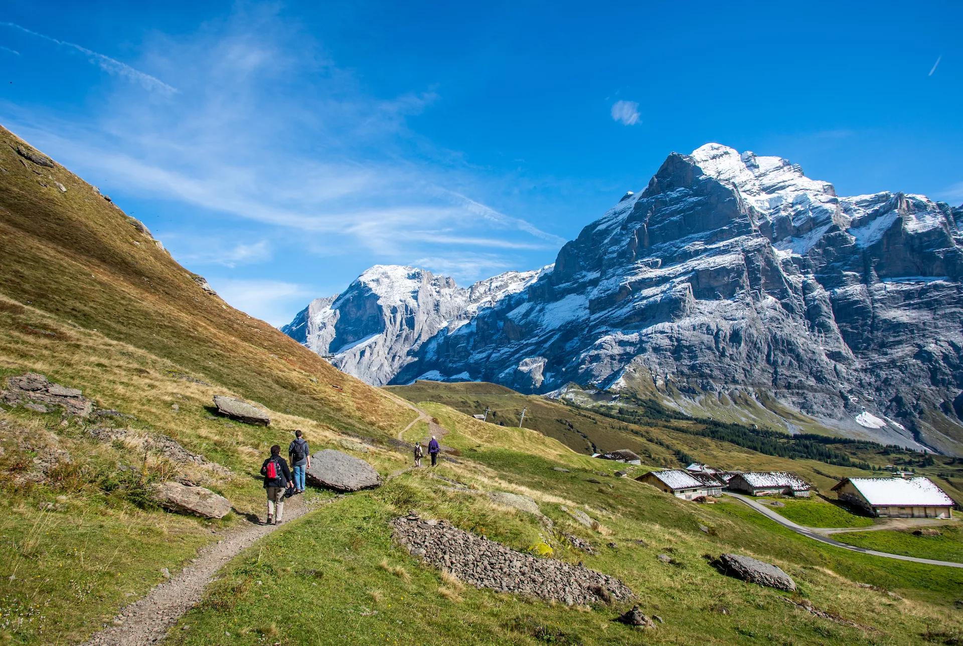
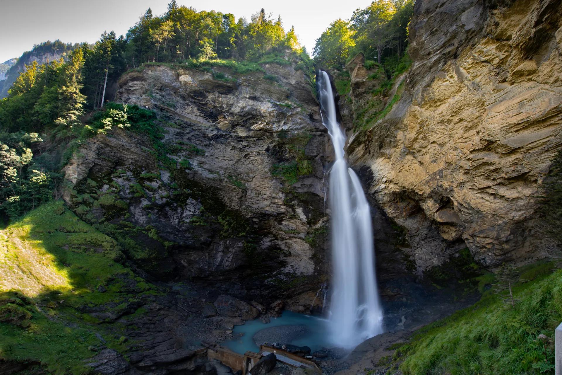
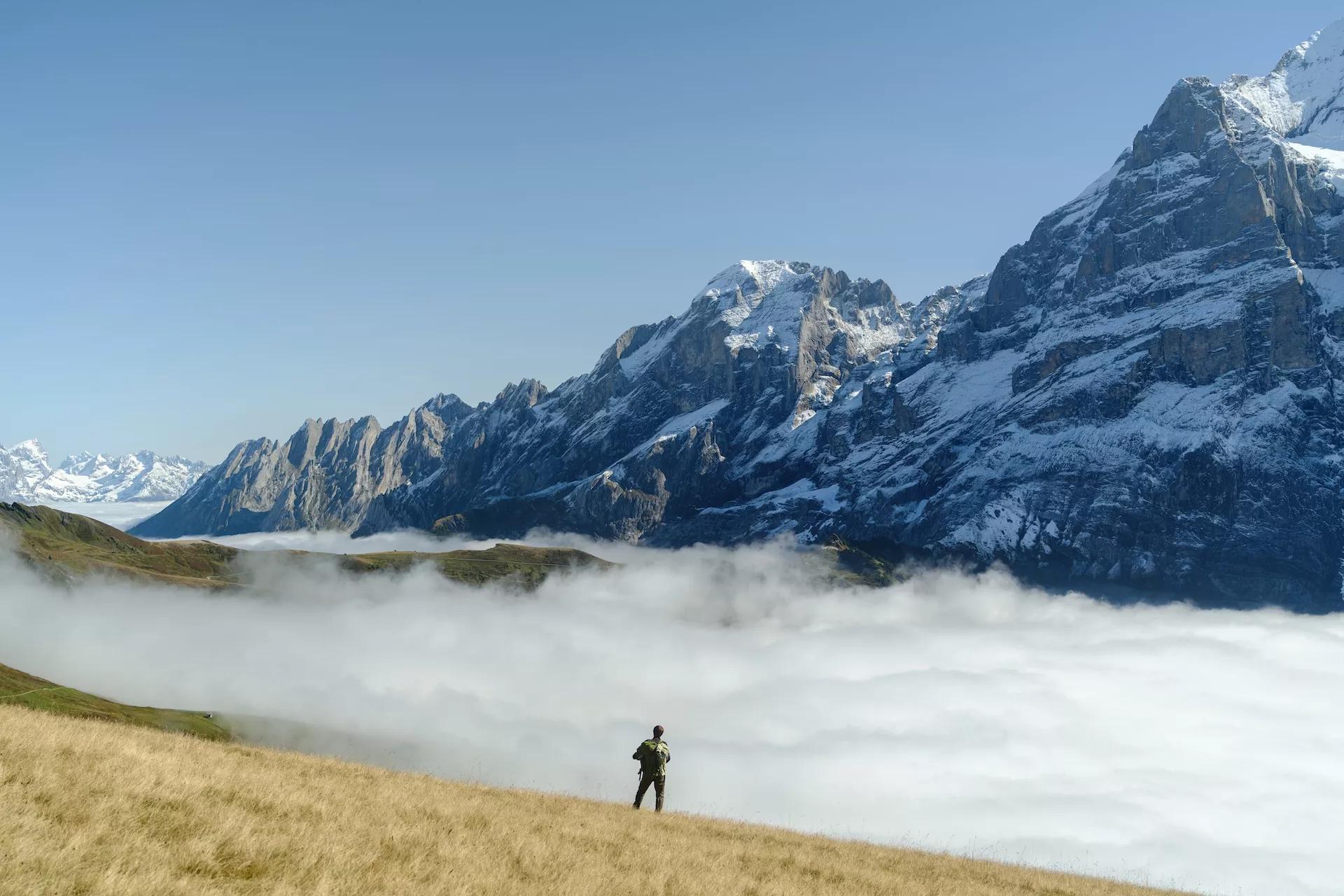
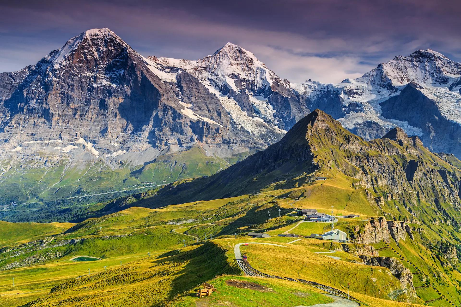
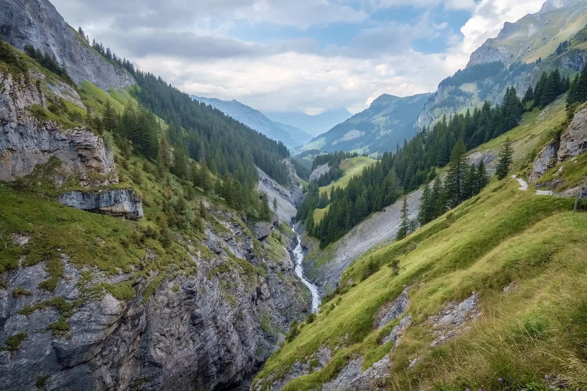
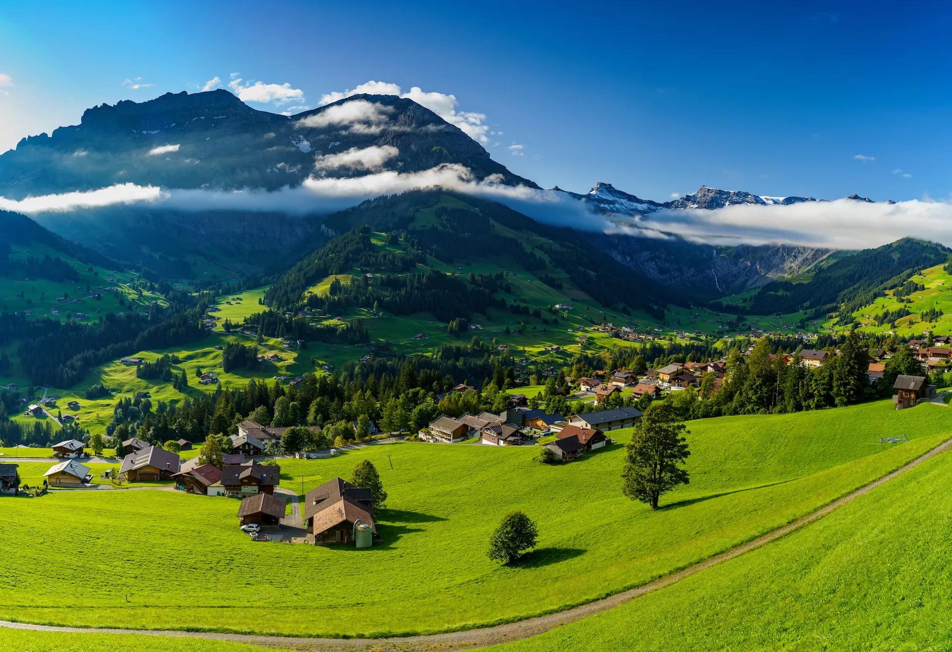
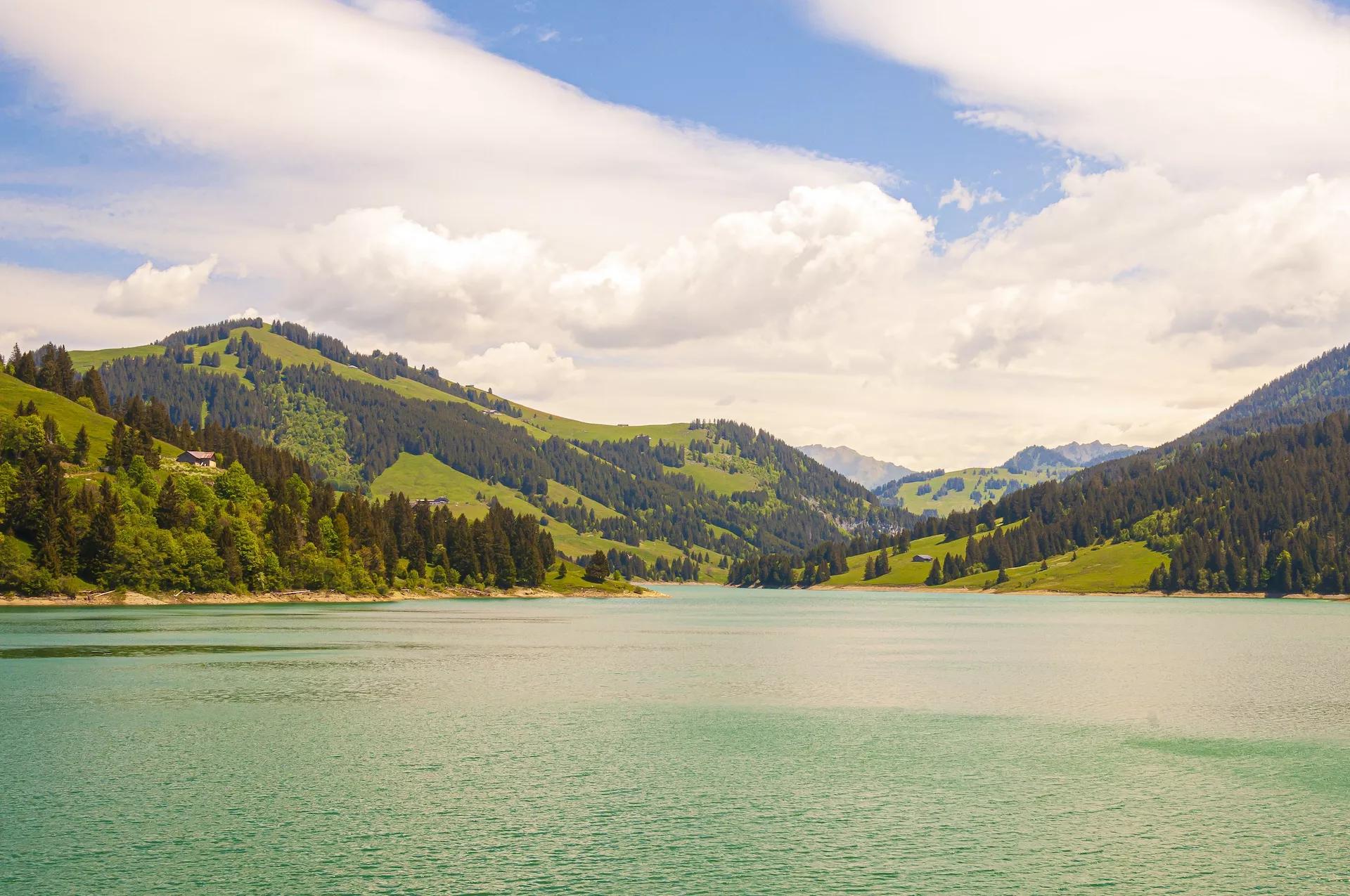
The Via Alpina is Switzerland’s number one hiking route, taking you over the 14 most beautiful mountain passes in the country, leading through a variety of culture, geology, flora, and fauna. It’s the best way to get to know the Swiss Alpine culture.

Also called the Swiss Alpine Pass Route, it starts in its east at the border with Liechtenstein and continues across the whole country to the west — ending at Lake Geneva. As a well-maintained trail, it is a hiker’s paradise.

It features 18 stages that require about 5-7 hours of walking per day to complete, but some can be shortened by the use of public transportation (cable cars and buses). It is less challenging technically than the Walker’s Haute Route, but fitness-wise it is quite similar.

To allow you to focus more on enjoying the trail and preparing for it on the physical side, we will take care of the logistical planning.

We take your wishes and preferences to best advise you on your perfect Via Alpina itinerary. We book all of your accommodations, organize luggage transfers, and more, so you can focus on the journey. And a few weeks before setting off, we’ll send you the detailed itinerary booklet with the planned GPS route.

If you think this hike is too long for you, or you don’t have the time, we also offer a shorter version of the trail — the Via Alpina: The Bear Trek.

Map

Start planning today!

The sooner the better - guaranteed availability and best prices if you don't wait for too long.
Inquire now

Things to know

The summer season for hiking is usually from mid-June to mid-October. Its start depends on the amount of snow left on the high mountain passes from the winter. The Walker’s Haute Route and Via Alpina have some high passes, which are usually free of snow only in July. Hiking before that could be dangerous without proper skill and equipment. In October, there is usually the first bigger snowfall, and the huts close to prepare for the winter ski season.

Read more about the hiking season in the Swiss Alps here.

We’ve rated our tours on a difficulty scale from 1 to 5 — with 1 being the easiest and 5 the most difficult.

The difficulty level of a tour tells you how fit you need to be and how much hiking is involved. Most of our tours are appropriate for people who are regularly active and can hike for about five to seven hours per day.

Technical difficulty means how skilled you need to be to hike on the path. Level 1 means the trail is smooth and wide (like a gravel road), while 5 means the surface is uneven and exposed, and you have to use your hands to help yourself move forward. In practice, that means that the higher the level, the more surefooted and skilled in scrambling you need to be.

It is best to book your tour early because most accommodations along the trail fill up quickly. That way, you can ensure that you have a place to stay.

Even though the routes are usually quite close to at least a farm or a small village, they also feature lots of wild and remote sections where you cannot just stop. In case of injury, it’s best to call the local emergency services.

On the other hand, if you just feel that you cannot hike anymore, you can always stop in any of the towns and villages along the way and use public transport to get to a bigger Swiss city.

Showers in Swiss mountain huts are rare and are only offered for an extra charge. That’s why it’s wise to bring wet wipes with you for the days that you are staying in one of them.

No, because the huts provide their own blankets and pillows. Still, you should bring a sleeping liner instead.

Cell connection is very changeable in the mountains. A good rule of thumb is that if you can see a town, you’ll have a reception. Mountain huts are the same — the signal usually doesn’t reach the insides, so try catching it outside. Wifi is available only in some huts, while most don’t have it.

If you dress accordingly, most stages can be done in light rain. However, do not hike if a storm is forecasted. In that case, you can take public transport to the next point when possible to make up for the lost time.

Vegetarian meals are usually available in most accommodations. Vegan options are harder to be found in huts, but we’re happy to let you know about them in advance so you can plan accordingly.

Via Alpina is less difficult than the Walker’s Haute Route but more difficult than the Tour du Mont Blanc. It is mostly a hike, with only a few steep, rocky, and exposed sections where you need to use your hands to keep balance.

Still, it features long days with lots of elevation gain and loss, mostly over uneven terrain, which is why only experienced hikers who can hike 4-7 hours a day should attempt it.

Learn more about the Via Alpina difficulty >

The starting point of the Via Alpina in Switzerland is Sargans, which can be easily reached by train from Zurich or Basel.

You end the hike in Montreux, from where a train can take you to Geneva airport.

You can find more details about the travel to the starting point here.

You can, but they need to be used of long hiking days and surefooted. We therefore recommend that they’re at least 8 years old.

Most of the stages can be shortened via cable cars or other modes of public transportation, saving your knees on the downhills or catching up on lost time because of bad weather.

Via Alpina stages are much more accessible than Haute Route’s, which is why we can organize luggage transfer for you for an extra charge. This will make your backpacks lighter and easier to carry over the many mountain passes of the route.

Switzerland uses Swiss francs (CHF), so it’s best to have them on you to pay for services in some remote mountain huts.

Klemen
Talk to our travel expert
mail
info@huttohuthikingswitzerland.com
phone
+386 31 22 44 88
Book a call
Usually replies within 4 hours!
Inquire now
Book now before it's gone
The accommodations are likely to sell out
Covid refund guarantee
Money-back in case of covid restrictions
Fast and easy booking
Book you activity in few minutes
Guaranteed best prices
No additional costs
Happiness Guaranteed
Or we will return your money
We care about the planet 🌍 Read more >
travel-life-logo tourism-logo green-safe-logo travel-agency-logo

Hassle-Free

We handle itineraries, accommodations, and anything else you prefer not to deal with, so you can enjoy a carefree hike.

Book with confidence

We are a financially protected company, fully bonded and insured, keeping your money safe and allowing you to travel with confidence.

Tried & Tested Adventures

Only the best hut to hut hikes of Switzerland, cherry-picked by our local team with an in-depth knowledge of the region.

Unbeatable support

Our 24/7 customer support is where we show our passion, bringing you a better experience by making your well-being our number one priority.

Similar Switzerland Hiking Tours

Lac des Cheserys with a view at the beautufil mountains of Chamonix
Pictures of Valley of Chamonix closer the village of Argentiere
Idyllic Trient river and valley in Valais
The alpine village of Trient in the canton of Valais
Champex a charming village surrounded by mountains and a lake
The town Le Chable in Swiss Alps seen from above on a clear bright summer morning
The views from the way to Col Termin
View from Cabane de Prafleuri
View of the Rosablanche glacier from Col de Prafleuri
From: 1390€/person
7 days / 6 nights
A short version of the iconic Walker’s Haute Route, leading you from the Chamonix valley below Mont Blanc to the mountain passes in the Swiss Alps.
More →
Panoramic trail from Mannlichen to Kleine Scheidegg with Mount Eiger view
Spectacular principal street of Lauterbrunnen with and stunning Staubbach waterfall in background
Kleine Scheidegg with Eiger Nordwand background
Amazing tourquise Oeschinnensee with waterfalls and Swiss Alps Kandersteg
Panoramic view of Lauterbrunnen valley village of Lauterbrunnen the Staubbach Fall and the Lauterbrunnen Wall
View to the mountain Eiger
The valley called Kiental
Fabulous autumn view of picturesque alpine Wengen village and Lauterbrunnen Valley
Hiking above Grindewald
Kleine Scheidegg train station
From: 1039€/person
Best Seller
7 days / 6 nights
Discover the highlights of the Swiss Via Alpina by hiking the Bear Trek, our favorite section of the classic long-distance trail in the European Alps.
More →
View of the Moiry Glacier from the Lac de Chateaupre surrounded by flowers in summer
A hiking trail leading towards Mont Collon near Arolla
Valais Blacknose sheep in front of Matterhorn
The Moiry Mountain Refuge in the Val d'Anniviers
Majestic Weisshorn seen from Col de Sorebois
Cows will be your loyal companions
Europaweg trail leads the eye trough lush green meadows to the distant Matterhorn
The Walliser alps peaks Bishorn, Weisshorn, Schalihorn, and Rothorn over the Mattertal valley
Zermatt town and Matterhorn mountain
From: 1560€/person
7 days / 6 nights
Spend a week on the eastern Haute Route, hiking through the Swiss Alps below sharp ridges and epic glaciers all the way to the foot of the iconic Matterhorn.
More →
The first stages of the Haute route share the trail with Tour du Mont Blanc
Pennine Alps near Zinal in the swiss canton Valais
Majestic Weisshorn seen from Col de Sorebois
The Walliser alps peaks over the Mattertal valley
Zermatt town and Matterhorn mountain
City of Martigny and Sembrancher in the Southern Switzerland
Sunset panorama of the Lac Blanc lake with Mont Blanc
Exciting morning view of Stellisee lake with Matterhorn peak on background
Beautiful day on the rocky road accross meadows in the Swiss Alps leading to the Fenetre d´Arpette pass
A hiking trail leading towards Mont Collon near Arolla
The Alphubel over the Mattertal valley
Lac Bleu above Arolla
Cows will be your loyal companions
From: 2395€/person
14 days / 13 nights
Set out on the Walker’s Haute Route self-guided and hike this iconic trek from Chamonix to Zermatt amongst the highest peaks of the Alps.
More →
Self-guided trekking tours in Switzerland, hiking from hut to hut across epic Alpine landscapes and enjoying hearty meals served alongside breathtaking views.
Portfolio company of World Discovery.